A practical guide to reading clouds at sea, from pressure and fronts to low clouds, high clouds, squalls and offshore decisions.
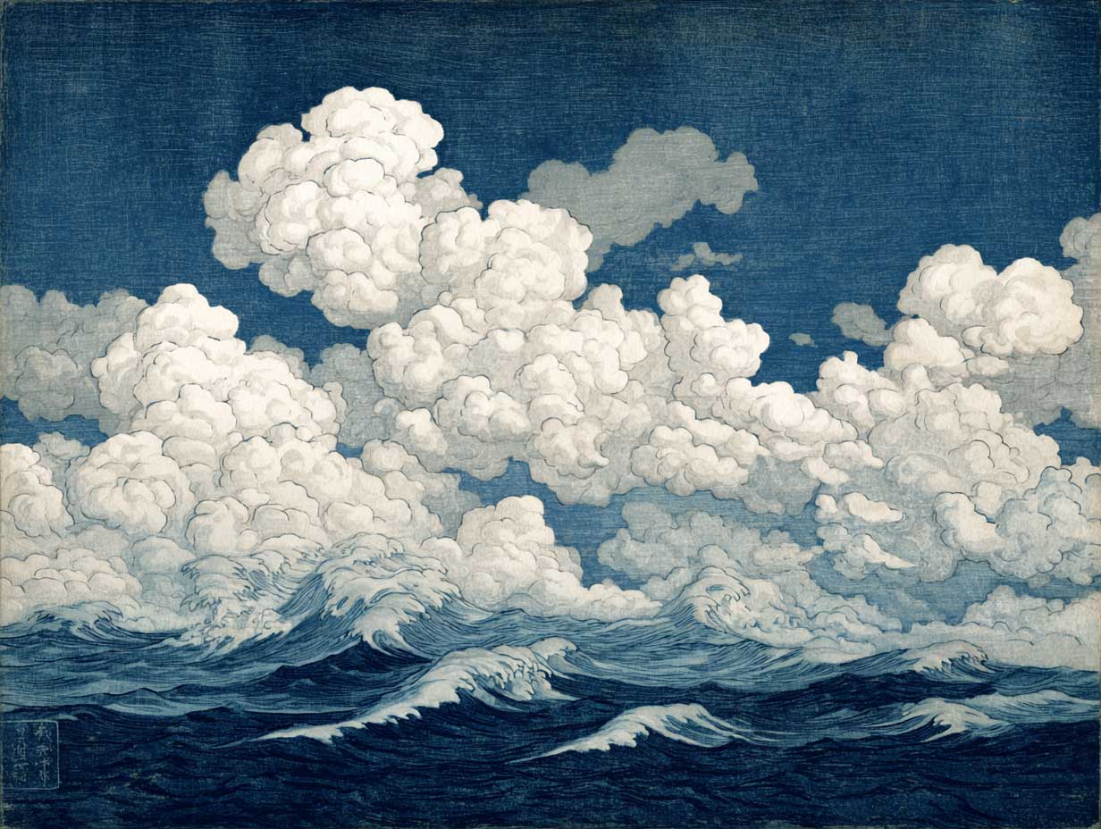
Reading clouds remains one of the oldest and most useful skills in sailing. Modern forecasts, satellite images and routing software have changed navigation, but the sky still gives direct evidence of what the atmosphere is doing above the yacht. Clouds show rising air, moisture, instability, pressure changes and approaching fronts. For a sailor, this is practical knowledge. Cirrus may announce a warm front. Cumulus may mark a fair-weather sea breeze. Stratocumulus may show a stable marine layer. Nimbostratus often means prolonged rain. Cumulonimbus demands immediate respect because it can bring squalls, lightning, violent wind shifts and steep seas. A Privilège catamaran is built for bluewater sailing, but good design never removes the need for observation. The best sailors read forecasts, instruments and clouds together. The eye remains part of seamanship.
The sky remains a working instrument for sailors
A yacht at sea is surrounded by instruments. The chartplotter shows position. The barometer shows pressure. The AIS shows traffic. The GRIB file gives wind forecasts. Radar shows rain cells. Satellite communications bring updated routing. Yet the sky remains the most immediate instrument on board.
Clouds are visible evidence of air in motion. They show where moisture is rising, where air is stable, where a front is approaching, where heat is building, and where a quiet morning may become a difficult afternoon. For a sailor, reading clouds is not romantic folklore. It is part of risk management.
At Privilège Marine, we build bluewater catamarans designed to cross oceans with confidence. That confidence depends on robust structure, reliable engineering and thoughtful comfort. It also depends on judgment. A well-prepared sailor does not look at clouds instead of the forecast. He reads them against the forecast. When the sky contradicts the model, the sailor pays attention.
Clouds rarely give one single answer. They provide clues. A line of dark bases to windward, a halo around the sun, a sudden tower of cumulus, or a low grey ceiling over cold water can all change a sailing decision. The question is not simply “Will it rain?” The better questions are: will the wind increase, will visibility fall, will the sea steepen, will a squall arrive, and should we reef now?
The science of cloud formation begins with rising air
Clouds form when moist air cools to its dew point and water vapour condenses into tiny droplets or ice crystals. This usually happens because air rises. As air rises, pressure decreases. The air expands and cools. If it contains enough moisture, condensation begins around microscopic particles such as salt, dust or aerosols.
For a sailor, this basic process explains much of the sky.
The air that rises through heat
On sunny days, land heats faster than sea. Warm air rises over land, and cooler marine air moves in to replace it. This creates the sea breeze. Small cumulus clouds may form above the heated land or along convergence lines where air streams meet. Near coasts, this is often the first visual sign that the afternoon breeze is developing.
A sailor approaching the Vendée coast, the Balearic Islands or the Caribbean shore can often see this process before feeling it. The clouds appear over land first. The breeze follows. The effect can be useful in coastal sailing. It can also complicate docking, anchoring or a late-afternoon return to harbour.
The air that rises over a front
A front is the boundary between different air masses. Warm air can rise gradually over colder air. Cold air can undercut warmer air and force it upward sharply. Both processes create cloud, but the cloud signatures differ.
A warm front often begins with high cloud. Thin cirrus may appear first, followed by cirrostratus, then altostratus and nimbostratus. The cloud thickens over hours. Rain may arrive before the surface front. The wind often backs or veers depending on hemisphere and local pattern. The barometer tends to fall.
A cold front is often more abrupt. The cloud may build vertically. Showers and cumulonimbus can form. Wind direction may shift quickly. Gusts can be severe. The sky may clear after the front, but the sea can remain rough.
The air that rises through convergence
Convergence happens when air flows together from different directions and is forced upward. At sea, convergence can occur along sea-breeze fronts, between trade wind streams, near islands, or ahead of squall lines. It often produces cumulus streets, showers and local acceleration zones.
A sailor crossing the Atlantic or moving between Caribbean islands should treat lines of cloud with care. A line of cumulus can indicate usable wind. A darker, taller, more organised line can indicate squalls.
The main cloud families give a useful order to the sky
The World Meteorological Organization recognises ten main cloud genera. For practical sailing, it helps to group them by height and form.
The broad height bands are simple. Low clouds usually have bases below about 2,000 metres (6,500 feet). Middle clouds usually sit between about 2,000 and 7,000 metres (6,500 to 23,000 feet). High clouds usually have bases above about 5,000 metres (16,500 feet). These limits vary with latitude and season, and some clouds grow vertically through several layers.
The ten classic cloud genera are cirrus, cirrocumulus, cirrostratus, altocumulus, altostratus, nimbostratus, stratus, stratocumulus, cumulus and cumulonimbus. A sailor does not need to recite Latin names for pleasure. He needs to understand what they imply.
The high clouds warn of changes above the horizon
High clouds are usually made of ice crystals. They often appear before the weather changes at sea level. Their value lies in timing. They can tell a crew that the atmosphere is already changing far above the mast.
The cirrus that signals upper-level movement
Cirrus clouds are thin, white and fibrous. They can look like hair, feathers or brush strokes. Alone, they may mean little. In a developing pattern, they can be the first visible sign of an approaching warm front or upper-level moisture.
For sailors, cirrus deserves attention when it spreads, thickens or arrives from a consistent direction. A sky that begins with isolated wisps and gradually becomes veiled may indicate that a frontal system is advancing. On a long passage, that is the moment to compare the sky with the barometer and the forecast.
The cirrostratus that softens the sun
Cirrostratus is a thin high veil. It can produce halos around the sun or moon because ice crystals refract light. A halo does not guarantee bad weather, but it often suggests increasing upper-level moisture. When cirrostratus follows cirrus and the barometer falls, a sailor should expect a more organised change.
The practical decision may be simple. Check the latest forecast. Inspect the deck. Prepare foul-weather gear. Consider sail plan before darkness. A cloud sign is most useful when it triggers preparation early.
The cirrocumulus that shows waves aloft
Cirrocumulus appears as small white patches, ripples or grains. It is less common than cirrus and often short-lived. It shows structure in the upper air and can indicate instability or wave motion aloft. For sailors, it is less decisive than cirrostratus or cumulonimbus, but it contributes to the general reading of the sky.
The middle clouds show the next stage of weather development
Middle clouds are often more operationally important because they thicken the sky, reduce solar heating and signal that weather is moving closer to the surface.
The altostratus that turns the day grey
Altostratus forms a grey or bluish sheet. The sun may appear as a weak disk, then disappear as the layer thickens. This cloud often belongs to frontal weather. It suggests broad uplift and increasing moisture.
At sea, altostratus matters because it changes the mood and the energy balance. The light fades. The air feels damp. The wind may become more organised. If the barometer is falling, the yacht is likely moving into a more active pressure pattern.
The altocumulus that deserves a second look
Altocumulus appears as rounded patches or layers. It can look like a mackerel sky. Many forms are harmless. One form deserves special attention: altocumulus castellanus. It has small towers rising from a middle cloud layer and indicates instability aloft.
For a sailor, castellanus in the morning can be an early warning. It suggests that the atmosphere is ready to build vertical clouds later in the day if moisture and lift increase. In warm waters, coastal zones and tropical passages, this can be a warning sign for showers or thunderstorms.
The nimbostratus that means persistent rain
Nimbostratus is a thick, dark, layered cloud that brings prolonged rain or snow. It is less dramatic than cumulonimbus, but it can be exhausting offshore. Visibility may fall. Decks remain wet. Watchkeeping becomes colder. Solar production drops. The sea can become confused if the wind shifts with the frontal system.
This cloud calls for endurance rather than emergency. The sailor should protect crew rest, manage energy, secure ventilation, and reduce avoidable deck work.
The low clouds speak directly to the boat
Low clouds are close enough to affect visibility, wind perception and immediate decisions. They often reflect the marine layer, local stability, surface cooling or shallow uplift.
The stratus that lowers the world
Stratus is a low, grey sheet. When it reaches the surface, it becomes fog. For sailors, stratus means visibility risk. In busy coastal waters, fog is a serious operational problem. AIS, radar, sound signals, lookout discipline and speed control become central.
Stratus often forms in stable air. It can appear over cold water when moist air moves above it. It may also form at night as the surface cools. A low ceiling with drizzle may look gentle, but it can make navigation demanding near traffic lanes, fishing gear, headlands and harbour entrances.
The stratocumulus that marks a stable marine layer
Stratocumulus is common over oceans. It appears as low rolls, patches or a broken grey-white layer. It often signals a relatively stable boundary layer. It may bring light showers, but it usually lacks the violence of deep convection.
For bluewater sailors, stratocumulus can be a sign of a steady trade-wind environment. It may also indicate limited solar charging and a cooler deck. In the Atlantic trades, rows of stratocumulus and cumulus can show wind direction and flow structure. The sailor can read the cloud streets like a rough sketch of the air.
The cumulus that begins as fair-weather information
Cumulus clouds have flat bases and cauliflower tops. Small cumulus with clear spacing usually indicates fair-weather convection. It can be good news. The air is rising locally, but vertical growth remains limited.
The danger begins when cumulus grows taller, darker and more organised. A small cotton cloud can become towering cumulus if the atmosphere is unstable. If it continues to build, it may become cumulonimbus. The sailor watches the top. Sharp, rising towers mean active uplift. A spreading anvil means the cloud has reached a high level and the storm has matured.
The cumulonimbus cloud is the sailor’s hard warning
Cumulonimbus is the cloud that demands action. It is a dense, towering cloud with major vertical development. Its top often reaches above 10 kilometres (35,000 feet), and its vertical extent can range from about 3 kilometres to more than 15 kilometres (10,000 to 50,000 feet). It can produce heavy rain, lightning, hail, violent downdrafts, waterspouts and abrupt wind shifts.
For sailing, the most dangerous part is often the gust front. Cold air descends inside the storm, hits the sea surface and spreads outward. The result can be a sudden wall of wind arriving before the rain. A yacht carrying too much sail can be overpowered within minutes.
On a catamaran, the response must be early. Multihulls have great form stability. They sail fast and level. They also reward disciplined reefing because they do not heel progressively like a monohull. A Privilège is built for offshore confidence, but seamanship still decides the sail plan. When a cumulonimbus is building to windward, the correct question is not whether the boat can carry the canvas now. The question is what the boat should carry when the squall arrives.
The visual signs are clear. Watch for a dark base, sharp vertical towers, an anvil top, curtains of rain, a shelf cloud, rapid movement, lightning, or a sudden cool outflow at deck level. At night, lightning behind cloud can reveal structure before radar shows the strongest rain. Offshore, the crew should reef early, secure loose gear, close vulnerable openings, brief the watch, and keep clear of metal during electrical activity where possible.
The barometer gives clouds their pressure context
Clouds show visible moisture and motion. Atmospheric pressure gives the wider structure. The barometer helps the sailor decide whether a cloud is local, frontal or part of a deepening system.
A slow fall may indicate an approaching low or front. A rapid fall deserves attention. A rising barometer often indicates improving or stabilising conditions, although strong winds can persist after a front. The absolute number matters less than the trend, speed of change and relation to the forecast.
For example, high cloud arriving with a steady pressure fall gives a stronger warning than high cloud under stable pressure. Growing cumulus under a hot afternoon sky may be local convection. Growing cumulus with falling pressure and an approaching trough carries more risk. A grey low layer under steady high pressure may be a marine layer rather than an incoming storm.
The best sailors keep a simple pressure log. Time, pressure, cloud type, wind direction, wind strength and sea state. After a few days offshore, this record becomes valuable. It shows whether the yacht is experiencing forecast conditions or entering something different.
The sailor reads clouds with wind, sea and time
A cloud has meaning because of context. The same cloud can matter differently depending on season, latitude, sea temperature, time of day and route.
In the Mediterranean, a summer cumulonimbus over land can spill gusts towards the coast. In the Caribbean, morning cumulus may grow into afternoon squalls. In the Bay of Biscay, layered cloud and falling pressure may announce a frontal passage. In the trade winds, low cloud streets can help confirm wind direction and consistency. In high latitudes, low cloud and fog may become the main navigational threat.
Time also matters. Small cumulus at 10:00 may be normal. Fast-growing towers at 10:00 suggest stronger instability. A halo around the moon after sunset may matter if pressure is falling. A black line of cloud at dawn may be an approaching squall line rather than harmless sunrise shadow.
This is where marine weather becomes a habit rather than a forecast download. The sailor looks, records, compares and decides. Reefing, delaying departure, changing watch routines, selecting an anchorage, altering course by 20 degrees or preparing radar guard zones are all practical outcomes of cloud reading.
The modern forecast and the human eye must work together
A serious skipper uses professional forecasts. He updates weather files. He studies synoptic charts. He understands pressure systems. He uses radar, satellite imagery and routing tools. He also goes on deck.
Technology has blind spots. A forecast may resolve the broad flow but miss a local thunderstorm. A GRIB file may show average wind and understate gusts. A model may describe the next six hours well, then fail around a coastline, island, headland or thermal effect. The cloud above the yacht can reveal that difference.
The discipline is simple. If the forecast says stable conditions and the sky shows rapid vertical development, believe the sky enough to prepare. If the barometer falls faster than expected, re-check the weather. If a line of cloud advances from windward, reduce exposure before it arrives. If fog forms near shipping lanes, treat visibility as the main hazard.
Good seamanship is rarely dramatic. It is a series of early, calm adjustments.
The sailor who looks up makes better decisions
Reading clouds will never replace modern meteorology. It gives the sailor a sharper relationship with the sea around him. It turns the sky from scenery into information.
For Privilège owners, this matters because bluewater cruising is about freedom with responsibility. A yacht capable of crossing oceans gives its crew time, range and comfort. The crew must still interpret the world outside the cockpit. Clouds show that world in motion.
The most useful cloud is not always the most beautiful. A thin veil of cirrostratus may warn of tomorrow’s front. A low stratus deck may force a radar watch. A morning castellanus field may suggest afternoon instability. A dark cumulonimbus may demand reefs before the first gust touches the water.
The sailor who reads clouds gains minutes, sometimes hours. At sea, those minutes matter. They allow sails to be reduced without panic. They allow crew to rest before bad weather. They allow a yacht to enter a harbour in daylight or remain offshore until visibility improves. They turn observation into judgment.
The sky has always spoken to sailors. The best ones still listen.