Category: Destinations

  • Sailing Croatia’s Dalmatian Coast and Kornati by Catamaran

    Sailing Croatia’s Dalmatian Coast and Kornati by Catamaran

    A practical owner’s guide to sailing Hvar, Vis, Korčula, Mljet and the Kornati, with the finest anchorages, restaurants and experiences.

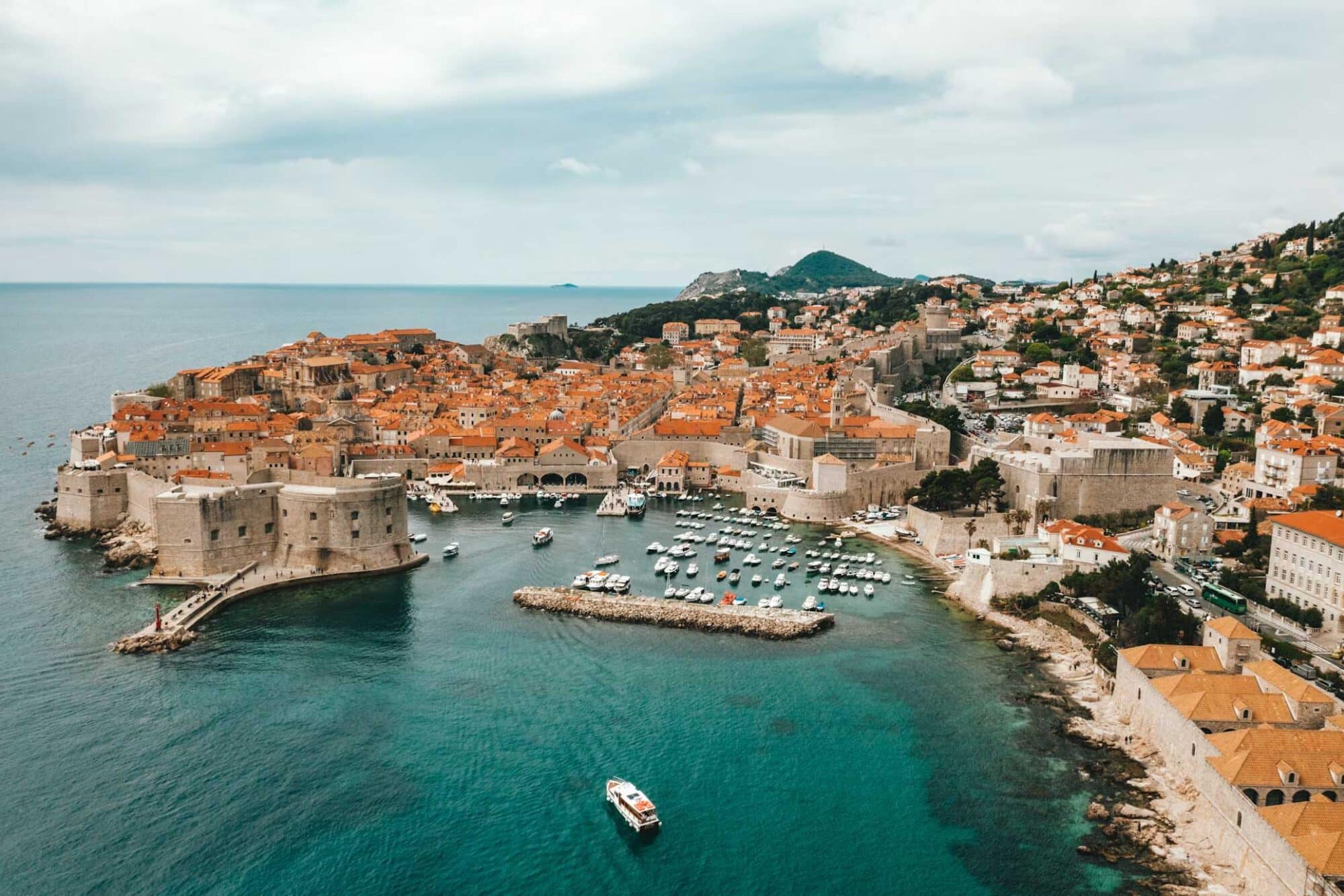
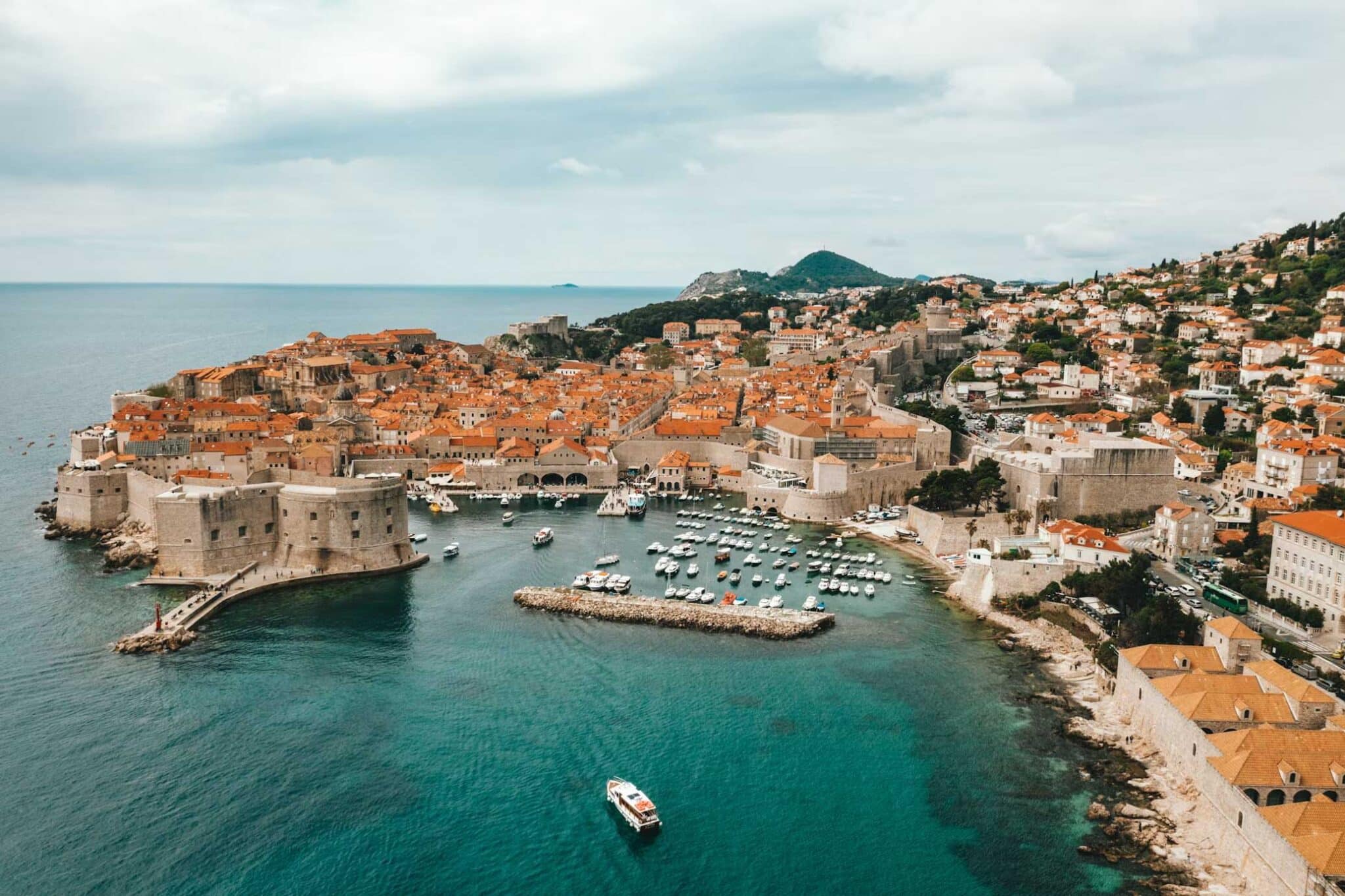
    Croatia’s Dalmatian Coast gives a large cruising catamaran an unusual concentration of sailing, culture, food and natural beauty. The classic route from Split through Hvar, Vis, Korčula and Mljet to Dubrovnik moves between historic ports, protected coves and sophisticated restaurants within relatively short passages. Farther north, the Kornati offer the counterpoint: 89 islands, islets and reefs scattered through a stark national park where the yacht itself becomes the destination.

    For a 15.2 to 21.3 metre (50 to 70 ft) catamaran, the main advantage is freedom at anchor; the principal constraint is beam when entering marinas. The best journey therefore alternates between berths, buoy fields and nights away from port.

    Hvar brings energy. Vis has character. Korčula brings wine. Mljet slows everything down. Dubrovnik supplies the finale. The Kornati deliver silence. Together, they make Dalmatia one of Europe’s most complete cruising grounds.

    The Dalmatian Coast is made for a large cruising catamaran

    A 50 to 70 ft catamaran fits the geography of Dalmatia remarkably well. The islands sit close enough together for sailing to remain part of the day rather than consume it. Deeply indented coastlines create route choices and shelter. Many of the finest places are better experienced from the water than from a hotel.

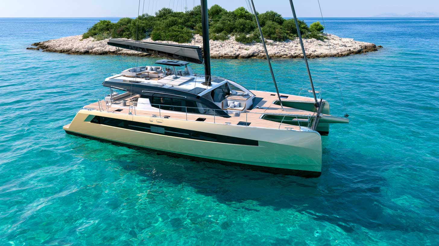
    This suits the way we design yachts at Privilège Marine. A Signature 510 has a draft of 1.57 metres (5.15 ft) and a beam of 7.98 metres (26 ft). The Signature 650 draws 2.04 metres (6.7 ft) and spans 9.21 metres (30 ft). The relatively shallow draft opens opportunities at anchor. The beam demands planning in port. A berth capable of receiving a 20-metre monohull does not automatically work for a large multihull.

    Croatia has the infrastructure to support serious cruising. In 2025, its coast counted 216 nautical ports, including 86 marinas and 18,850 moorings. Only 1,045 moorings were designed for vessels over 20 metres, however, while average occupancy of sea moorings reached 78 per cent. Large-catamaran owners should reserve the important nights and retain flexibility elsewhere.

    The southbound route from Split deserves at least a week

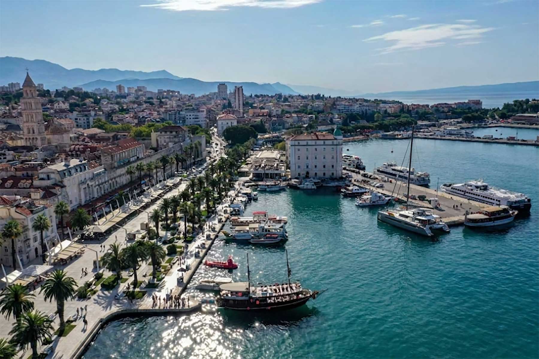
    Start in Split. Spend an evening inside Diocletian’s Palace before casting off. The Roman complex dates from around AD 300 and has been UNESCO-listed since 1979. It establishes the pattern for the entire cruise: major European history sits directly beside the quay.

    The Hvar and Pakleni Islands combine glamour with real cruising

    Hvar works particularly well from a yacht because you can enjoy the town and leave when you choose. Walk to the fortress, have dinner on the waterfront, then move among the Pakleni Islands for swimming and quieter nights.

    Vinogradišće Bay on Sveti Klement is an essential stop. Laganini Lounge Bar & Fish House has been operating in Palmižana for more than 50 years. It is the place for a long lunch built around Adriatic fish, scampi and tuna, followed by cocktails close to the water.

    Nearby, Carpe Diem Beach Hvar delivers the more energetic side of the island, with cabanas, a restaurant, music and after-beach drinks. Its late-night programme has faced local restrictions, so owners should check the current schedule rather than build an evening around assumed opening hours.

    Back in Hvar Town, Gariful remains one of the island’s best-known waterfront institutions for fish and seafood.

    Large-catamaran owners should note one important detail. ACI Marina Palmižana publishes a maximum daily vessel length of 15 metres. That is below the length of most 58 to 70 ft catamarans and even marginal for a genuine 50-footer. A marina night there should therefore be confirmed in advance rather than assumed.

    Hvar also deserves time ashore. The UNESCO-listed Stari Grad Plain still follows agricultural divisions laid out by Greek settlers in the fourth century BC. Grapes and olives have been cultivated across the same landscape for roughly 24 centuries.

    The island of Vis offers the route’s strongest personality

    Vis feels more remote. Its coastline is dramatic and development remains relatively restrained.

    Visit Stiniva with the tender rather than trying to manoeuvre a large catamaran through its narrow and often busy entrance. The Blue Cave on Biševo also belongs on an early-morning programme, subject to sea conditions and local access arrangements.

    For dinner, Pojoda is one of the classic addresses for Dalmatian fish cooking. For sunset drinks and a more polished evening, head to Fort George, the nineteenth-century fort overlooking Vis.

    A day ashore can combine the island’s former military tunnels with a winery visit. Vis produces distinctive local whites alongside Plavac Mali reds. This is one island where leaving the waterfront for several hours pays off.
    The Korčula and Mljet leg changes the rhythm

    Korčula brings another dimension to a Dalmatian sailing itinerary. The old town is compact, elegant and easy to explore from the harbour.

    ACI Marina Korčula has 166 berths and can accommodate daily vessels up to 50 metres. Length therefore becomes less problematic here, although a large catamaran should still reserve according to beam.

    Wine is central to the island. Pošip and Grk are the varieties to know. Pošip is associated particularly with Čara and Smokvica, while Grk comes from vineyards around Lumbarda. Both are indigenous white grapes and pair naturally with Adriatic fish and shellfish.

    For a destination dinner, LD Restaurant holds a Michelin star and combines Dalmatian produce with modern technique.

    For something more rooted in the island, drive inland to Konoba Mate in Pupnat. The family-run restaurant works with its own vegetables, cheeses, olive oil and local produce and has earned Michelin Bib Gourmand recognition.

    Continue south to Mljet. Use Pomena or Polače as a base, then spend several hours walking, cycling, swimming or kayaking around Veliko Jezero and Malo Jezero.

    This is precisely where an owner’s catamaran changes the experience. You can remain surrounded by nature without sacrificing the comfort of home.

    The Dubrovnik finale should begin at Šipan

    Keep one long lunch before Dubrovnik for Bowa Restaurant on Šipan. Its secluded bay, Adriatic fish, Mali Ston oysters, garden vegetables and island olive oil make it one of those restaurants that makes considerably more sense when approached from the sea.

    Dubrovnik itself deserves a proper night ashore. Its Old City has been a UNESCO World Heritage site since 1979 and reflects centuries of maritime wealth, trade and political independence.

    For dinner, Restaurant 360 is the serious choice. Michelin awards it one star. The restaurant occupies part of the historic walls and maintains a wine cellar of roughly 450 labels.

    ACI Marina Dubrovnik has 371 berths and can accommodate daily yachts up to 45 metres, making it a useful service, provisioning and turnaround point for a large catamaran.

    The Kornati offer an entirely different Croatia

    The Kornati deserve their own cruise rather than a rushed extension of the Dubrovnik route. Approach them from Šibenik, Murter or Zadar.

    Kornati National Park covers 217 square kilometres. Its 89 islands, islets and reefs create 238 kilometres of coastline. There are few distractions here. Pale limestone, dry-stone walls and transparent water dominate the landscape.

    Sail between Kornat, Levrnaka, Lavsa and Piškera. Take the tender towards Lojena beach. Swim and snorkel. Organised diving is regulated, while anchoring and overnight stays are permitted only in designated locations within the park.

    Planning also saves money. During the June to September 2026 season, a one-day park ticket purchased before entry costs €95 for vessels from 11 to 17.99 metres and €160 for vessels from 18 to 24.99 metres. Buying inside the park raises those prices to €190 and €320 respectively.

    Then build an evening around Konoba Opat. It is reached by boat and remains one of the defining nautical dining experiences of the Kornati, centred on the day’s catch and simple Adriatic cooking.

    The food is best when Dalmatia keeps things simple

    Dalmatian cooking needs little decoration. Order grilled whole fish, scampi na buzaru, black risotto, octopus salad and peka when a traditional konoba has time to prepare it properly.

    On Hvar, look for gregada, a simple fish stew built around potatoes, onion, olive oil and white wine.

    Follow the wine geographically. Hvar and Vis bring island whites and Plavac Mali. Korčula brings Pošip and Grk. Pelješac, opposite Korčula and Mljet, produces some of Croatia’s most serious Plavac Mali reds.

    The best meals will not necessarily be the most expensive ones. A fish grilled metres from the yacht in the Kornati can make more sense than an elaborate tasting menu. Dalmatia rewards context.

    The Adriatic winds should decide the rhythm

    Three names matter: maestral, bura and jugo.

    The summer maestral is the welcome north-westerly sea breeze that generally develops through the day and weakens towards sunset. It often creates the most enjoyable sailing conditions of the summer season.

    The bura comes from the north-east. It can descend rapidly from the mountains and produce violent gusts, particularly close to the mainland and around exposed channels.

    The south-easterly jugo develops more progressively and can build an uncomfortable sea.

    For a large catamaran, the lesson is straightforward. Choose the night’s shelter before the afternoon becomes committed. Check the marine forecast continuously. Keep one day unallocated in the programme. A bluewater catamaran provides range, autonomy and security. Local seamanship still determines the quality of the cruise.

    The real luxury is deciding where tomorrow happens

    Dalmatia is at its best when the yacht remains the centre of the journey.

    Sail for three hours. Swim before lunch. Stay another night because the bay is perfect. Leave early because Vis looks better. Move from a quiet anchorage to a Michelin-starred restaurant without changing hotels, packing a bag or following a fixed itinerary.

    This is also the logic behind a Privilège. We build ocean-going catamarans capable of crossing oceans, then design them as genuine floating homes once they arrive. Croatia shows why those two ideas belong together.

    Offshore capability brings you there. Comfort and autonomy allow you to stay.

    The result is freedom of choice: a silent anchorage tonight, a remarkable table tomorrow, and another island waiting beyond the headland.
  • Sailing the Bermuda Triangle: The Myth, the Sea and the Islands

    Sailing the Bermuda Triangle: The Myth, the Sea and the Islands

    A practical sailing guide to the Bermuda Triangle’s myths, real offshore risks, Bermuda’s anchorages and the island experience for large catamarans.

    The Bermuda Triangle is one of the ocean’s most successful stories. It is not an officially defined sea area, and neither NOAA nor the United States Coast Guard considers it uniquely dangerous. Yet the legend grew from real losses, including USS Cyclops in 1918 and Flight 19 in 1945, then expanded through decades of sensational books and television. For sailors, the practical risks are less mysterious: the Gulf Stream, fast-changing weather, tropical systems, fatigue, traffic and Bermuda’s extensive coral reefs. A well-prepared offshore yacht should treat the passage with respect, not fear. Bermuda itself is a compelling landfall. St. George’s offers history and straightforward clearance. The Great Sound gives broad-beam catamarans room to anchor. Hamilton brings urban energy, while Castle Harbour offers greater seclusion. For a large Privilège catamaran, the key considerations are weather routing, daylight arrival, reliable communications, anchoring discipline and advance confirmation of marina beam limits.

    The Triangle was created by storytelling, not cartography

    The first fact is also the most important. The Bermuda Triangle is not an official place. It has no internationally accepted coordinates, no legal boundary and no special status on nautical charts. Its usual outline joins Miami, Bermuda and Puerto Rico, creating a vast section of the western North Atlantic.

    The name entered popular culture in 1964. The American writer Vincent Gaddis used “The Deadly Bermuda Triangle” as the title of an article in Argosy, a pulp magazine. Charles Berlitz turned the idea into a global phenomenon with his 1974 bestseller, The Bermuda Triangle.

    The formula was irresistible. It combined aviation, deep water, tropical weather and unexplained loss. It also benefited from selective storytelling. Incidents separated by decades were presented as parts of one pattern.

    Official assessments are less dramatic. NOAA states that there is no evidence of mysterious disappearances occurring more frequently inside the supposed Triangle than in other large, heavily travelled ocean areas. The United States Coast Guard does not recognise it as a zone of special hazard and has found no extraordinary factor behind the casualties it reviewed.

    Some losses remain unresolved because wreckage was never recovered. Deep water, rapid currents and limited historical records can leave permanent uncertainty. An unexplained loss is not evidence of a supernatural cause.

    The disappearances that gave the myth its power

    USS Cyclops remains one of the legend’s darkest episodes. The 165-metre (542-foot) United States Navy collier disappeared in March 1918 while sailing from Barbados towards Baltimore. The ship carried 306 crew members and passengers. No confirmed wreckage was found.

    Later naval analysis considered the ship’s structural characteristics, its heavy manganese ore cargo, loading stresses and severe weather among the plausible explanations. The loss remains officially unresolved. That is not the same as inexplicable.

    Flight 19 added aviation mystery to maritime folklore. On 5 December 1945, five TBM Avenger torpedo bombers left Fort Lauderdale on a routine training mission. They failed to return. Radio exchanges suggested navigational confusion and uncertainty about their position. The aircraft entered deteriorating weather and eventually exhausted their fuel. A rescue aircraft was also lost during the search.

    The legend often removed this operational context. Wartime aircraft had limited navigation equipment. Weather information was sparse. Position fixing depended on compass headings, estimated speed, elapsed time and visual references. A small initial error could become a large final error.

    The supernatural explanations fail a basic test

    The most famous theories include Atlantis, extraterrestrial intervention, time distortions, magnetic vortices and methane eruptions from the seabed. None has produced credible evidence.

    The compass story deserves a technical answer. A magnetic compass points towards magnetic north, not normally geographic north. The angular difference is magnetic variation, which changes according to location and over time. Navigators correct for it.

    A compass can also be affected by electrical equipment, ferrous objects, wiring, loudspeakers and poor calibration. That is a vessel problem, not an ocean anomaly.

    Rogue waves, waterspouts and violent squalls are real. They can damage vessels anywhere. They do not prove the existence of a special destructive mechanism inside the Bermuda Triangle.

    sailing Bermuda

    The real ocean is challenging enough

    A sailor does not need paranormal explanations to respect this part of the Atlantic. The physical environment already provides a serious test.

    The most influential feature is the Gulf Stream. NOAA gives its average speed as approximately 6.4 kilometres per hour (4 miles per hour), with typical maximum surface speeds near 9 kilometres per hour (5.6 miles per hour). For a sailing yacht, that current can materially change course over ground, arrival time and sea state.

    The 1,178-kilometre (636-nautical-mile) Newport Bermuda Race has crossed this water since 1906. Its long record is useful evidence. Thousands of yachts have completed the passage safely. The race is nevertheless known as the “Thrash to the Onion Patch” because wind against current can build steep, confused seas.

    The Gulf Stream is a routing problem, not a legend

    The Gulf Stream is not a fixed blue river. Its axis moves. It develops meanders, warm eddies and cold eddies. A current chart that is several days old may already be misleading.

    For a yacht approaching from the United States East Coast, the critical decision is where and at what angle to cross the main stream. A favourable crossing may add speed. A poor crossing may push the yacht sideways for hours.

    Strong northerly or north-easterly wind against the north-flowing current can produce short, breaking waves. The danger is not necessarily their absolute height. It is their steepness, frequency and disorganisation. The motion can become violent, while slamming loads increase rapidly.

    A large cruising catamaran brings advantages. It offers speed, redundancy, good watchkeeping spaces and a stable living platform. It also has substantial windage and high structural loads. The correct response is not to drive the boat harder. It is to reduce sail early, protect the crew and preserve the systems.

    On a Privilège, offshore capability is built around autonomy and redundancy. Twin engines, duplicated critical systems, robust energy management and protected watchkeeping reduce the consequences of a single failure. They do not remove the need for weather routing and disciplined seamanship.

    The weather window matters more than the destination

    The official Atlantic hurricane season runs from 1 June to 30 November. Historical activity peaks around 10 September, with the busiest period generally extending from mid-August to mid-October. Bermuda can be affected directly or indirectly by tropical systems.

    Spring and early summer are popular for passages from the United States. Autumn may suit yachts heading south, but tropical risk remains part of the calculation.

    Winter creates a different problem. Strong cold fronts can move rapidly off North America and generate gales, large seas and abrupt wind shifts. Behind a front, the wind can oppose the Gulf Stream and make conditions considerably worse than the wind speed alone would suggest.

    The sensible skipper studies the full route, not only the forecast at departure. Satellite communications allow regular updates, but forecast models still diverge. Squall lines can form between forecast points. Equipment can fail.

    A safe plan includes sea room, conservative sail choices and the possibility of delaying landfall.

    The approach to Bermuda rewards precision

    Bermuda’s offshore passage is often less difficult than its final approach. The islands are surrounded by coral reefs. On the northern side, those reefs extend as far as 16 kilometres (10 miles) offshore.

    Government guidance warns against pressing into unfamiliar local waters after dark. The Town Cut entrance into St. George’s Harbour is well marked, but darkness, rain or poor visibility remove the visual information that makes reef navigation safer.

    A daylight landfall is the professional choice. It allows the crew to identify water colour, breaking reef, buoys, traffic and any discrepancy between charted and observed conditions.

    Electronic charts, radar and accurate GNSS positioning are essential, but none should be treated as infallible. Large-scale official charts and current Notices to Mariners remain necessary. The Bermuda Department of Marine and Ports regularly publishes warnings about missing buoys, extinguished lights, diving operations and local traffic restrictions.

    Visiting yachts are asked to contact Bermuda Harbour Radio approximately 56 kilometres (30 nautical miles) from the islands on VHF channels 16 or 27. The station provides arrival instructions and directs yachts towards clearance in St. George’s Harbour.

    The yellow Q flag should be flown until formalities are completed. The principal yacht reporting and customs facility is at Ordnance Island.

    Arrivals between midnight and 08:00 may be directed to Powder Hole. The yacht must remain in the quarantine area until clearance becomes available. Current visitor guidance also requires advance electronic reporting through SailClear.

    Formalities are not especially burdensome, but they should be prepared before departure. Passports, vessel documents, insurance records, crew details and health declarations must be readily available.

    The large catamaran changes the anchoring equation

    Official guidance states that overnight anchoring is generally free, provided the vessel does not obstruct navigation channels or existing moorings. The choice of anchorage still requires judgement.

    For a large catamaran, the beam matters more than the draft when selecting a marina. A shallow draught helps in protected waters, but it does not justify crossing poorly surveyed reef areas. The broad beam may eliminate otherwise suitable berths.

    High freeboard creates another consideration. A large catamaran presents considerable surface area to the wind. The resulting load on the anchor can rise sharply during a squall, even when the water remains relatively flat.

    The skipper should confirm berth width, manoeuvring room, shore-power compatibility and fendering before entering a marina. At anchor, the crew should identify clear sand or mud, avoid coral, calculate swinging room for the full forecast and account for neighbouring monohulls that may swing differently.

    The St. George’s Harbour anchorage is the logical first stop

    St. George’s Harbour is the most practical arrival base. Powder Hole is sheltered, close to clearance and within dinghy distance of the historic town. It suits a large cruising catamaran better than a rushed attempt to secure a berth immediately after an offshore passage.

    The anchor should still be set under load and its position verified. Squalls can funnel across the island, while commercial and recreational traffic moves through the harbour.

    For marina comfort, St. George’s Marina and Superyacht Dock offers berthing, provisioning and fuel close to Ordnance Island. Bermuda’s tourism authority states that it can handle yachts up to 100 metres (328 feet).

    A large sailing catamaran is comfortably within the marina’s stated length range. Its beam must nevertheless be declared in advance. Length alone does not determine whether a multihull can be accommodated.

    The Great Sound gives a catamaran room to breathe

    The Great Sound is Bermuda’s best-known large natural harbour. A reef barrier across its entrance reduces Atlantic wave energy. The available space is attractive for a broad-beam catamaran, particularly when the crew wants privacy, water access and sufficient room to swing.

    It is also a strong base for the Royal Naval Dockyard and the West End. Pier 41 Marina provides services in Dockyard, while the wider sound offers anchoring opportunities.

    Current charts and local guidance remain essential. Reef edges, channels and moorings create a landscape that is visually beautiful but operationally unforgiving.

    Hamilton Harbour is the urban alternative. It gives immediate access to restaurants, shops, provisioning and the capital. It also brings ferry traffic, wake and less solitude. The Hamilton Princess Marina offers full-service facilities and can accommodate very large yachts. Advance booking is essential for a wide catamaran.

    Castle Harbour is the quieter choice. It is scenic, protected and close to Tucker’s Town. It can provide a more private Bermuda sailing experience, but the entrances and surrounding reefs demand careful pilotage.

    Mangrove Bay and Somerset are also listed as popular anchoring areas. A very large catamaran should assess access, turning room, bridge restrictions and local traffic before treating them as routine options.

    The islands are better than the legend suggests

    Bermuda is not merely a technical stop between weather systems. It is a destination with enough character to justify several days.

    St. George’s is the natural beginning. Founded in 1612, the town and its related fortifications form a UNESCO World Heritage Site. White stepped roofs collect rainwater. Narrow streets lead from King’s Square towards old churches, stone buildings, small museums and waterfront restaurants.

    After several days offshore, its scale feels civilised rather than staged. It remains closely connected to the sea. Yachts are not hidden in a distant marina district. They arrive beside the old town.

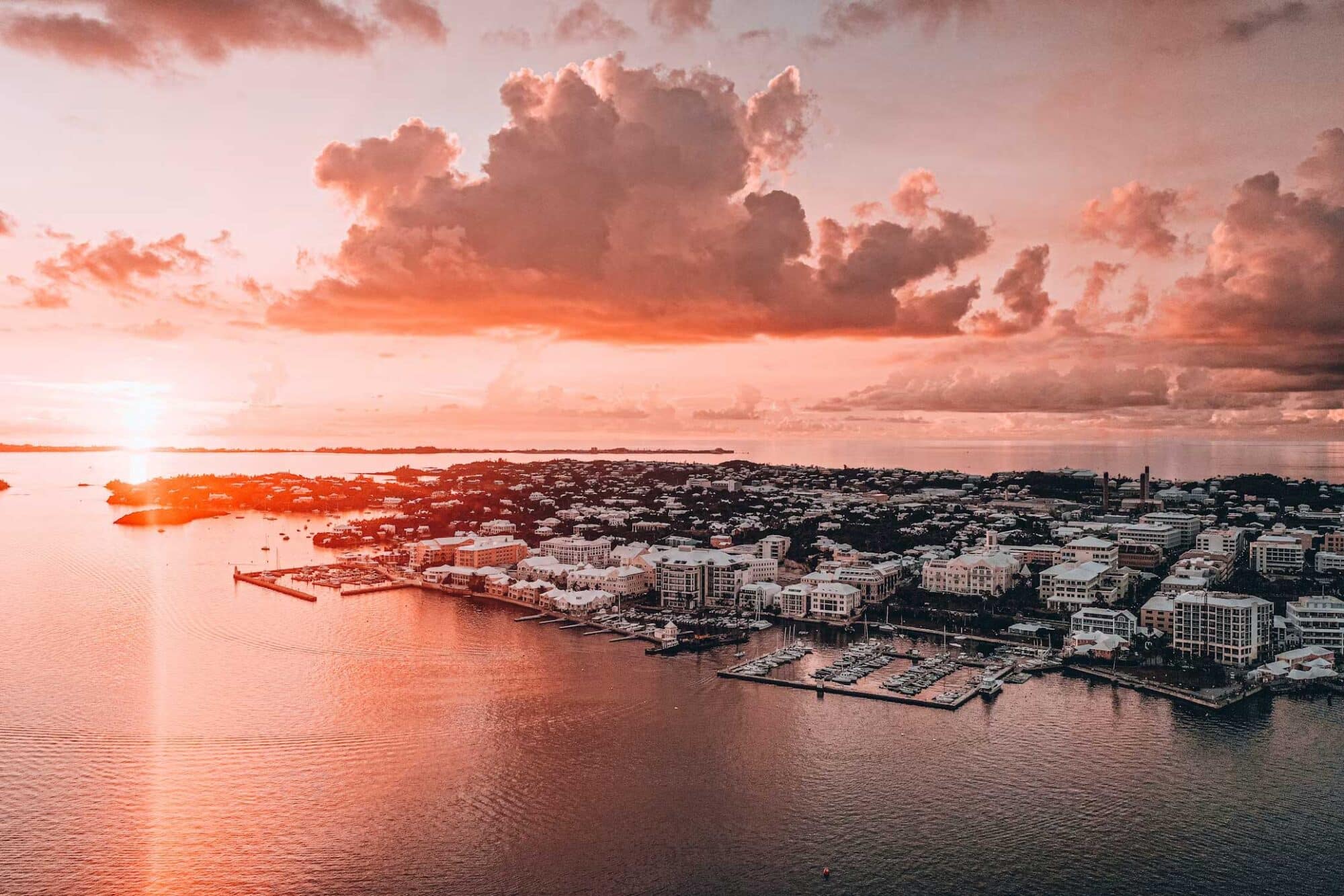
    Hamilton provides the contrast. Front Street is polished and commercial, with pastel façades facing the harbour. The city works well for provisioning, dining and crew logistics. It is not Bermuda’s most intimate place, but it is the most efficient.

    The Royal Naval Dockyard carries greater architectural weight. The former military complex now combines the National Museum of Bermuda, workshops, restaurants, shops and marine services. It makes a practical day ashore from the Great Sound.

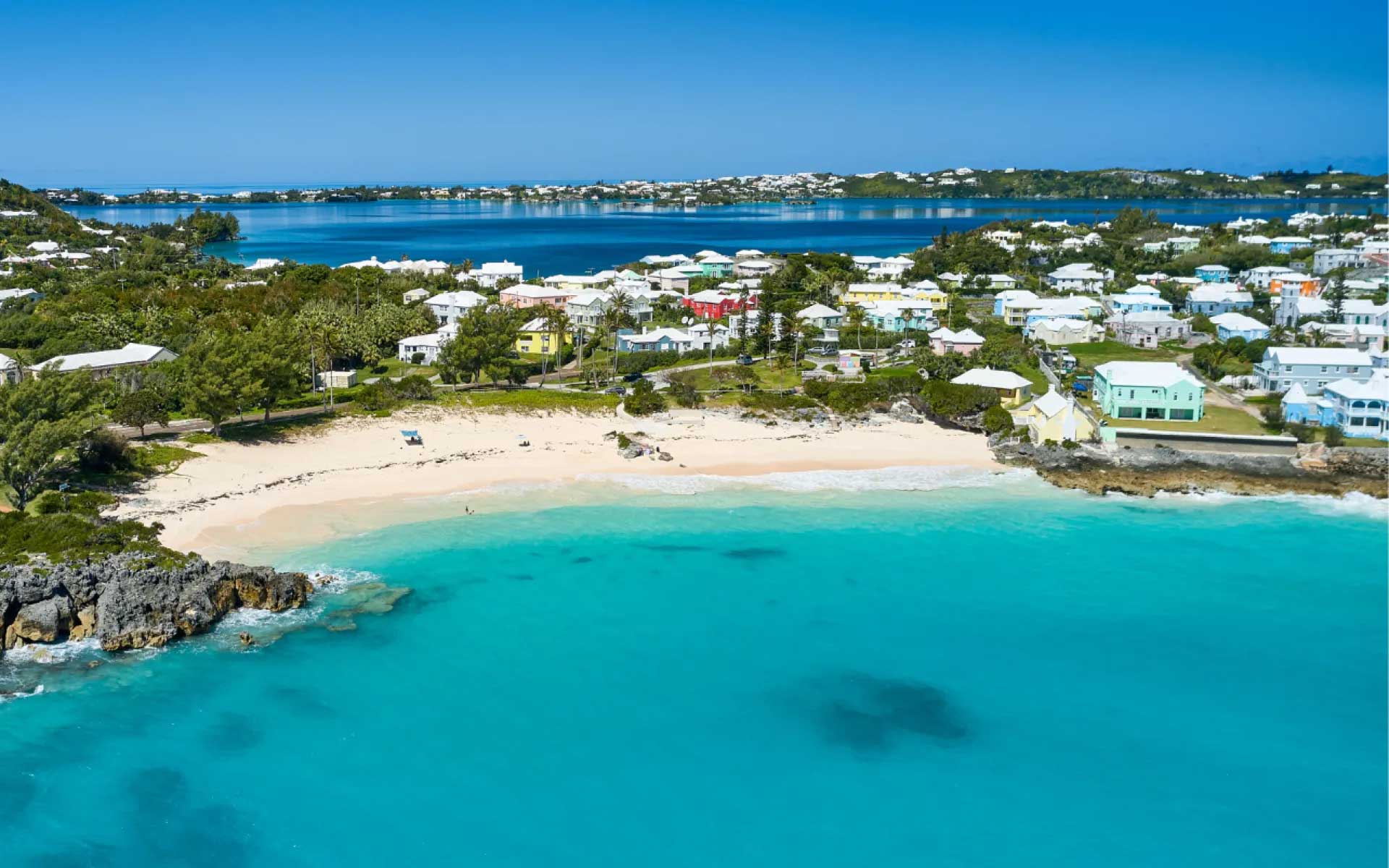
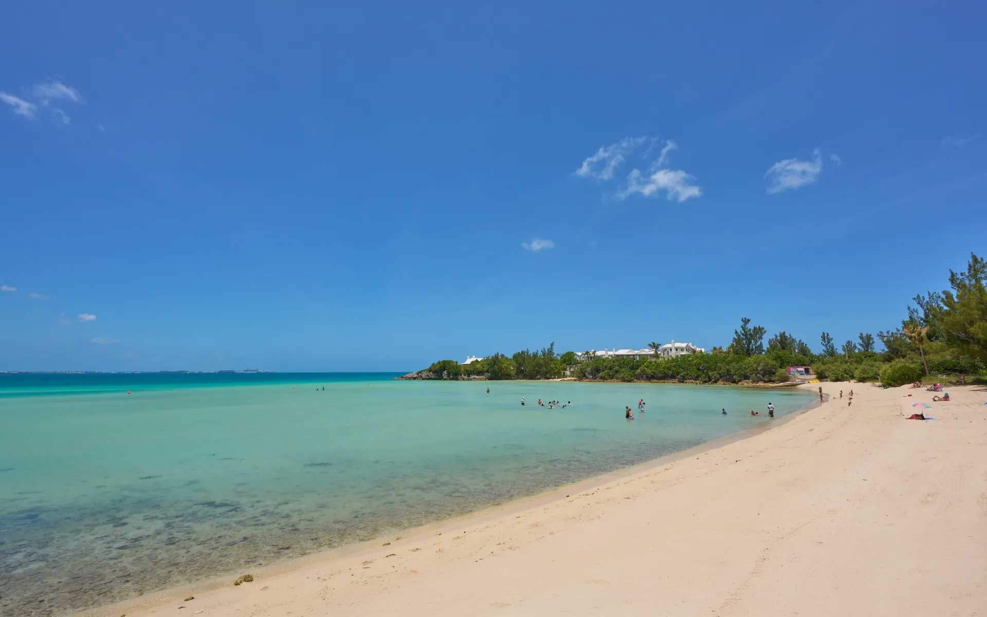
    The beaches justify their reputation. Horseshoe Bay has pale pink sand, clear water and limestone formations. It can be busy, particularly when cruise ships are in port. The adjoining South Shore paths lead towards quieter coves and Warwick Long Bay. The better experience is often found beyond the main access point.

    Below the water, Bermuda’s wreck history becomes an attraction rather than a warning. Local tourism authorities count more than 300 sunken vessels around the reefs. Diving and snorkelling can combine coral, clear Atlantic water and wreck structure in the same outing.

    The Crystal Caves offer limestone chambers and clear underground pools. The former Bermuda Railway route has become a trail linking coastline, woodland and settlements. It is one of the simplest ways to see parts of the island that are invisible from the main roads.

    Bermuda is expensive. Provisioning, dining and marina services reflect its remote location and high operating costs. That should be budgeted honestly.

    Yet the quality of the stop is high. The island is compact and well served by buses and ferries. A yacht crew can move from harbour to beach or historic site without turning the visit into a logistical exercise.

    The myth ends where seamanship begins

    Sailing the Bermuda Triangle is not an encounter with a forbidden sea. It is an offshore passage across a busy and meteorologically active part of the North Atlantic.

    Its risks are identifiable. They include current, weather, fatigue, navigational error, machinery failure and reef approach.

    For a Privilège owner, the correct attitude is straightforward. Use the yacht’s range, stability and redundancy. Do not confuse capability with invulnerability. Cross the Gulf Stream with a current plan. Reef early. Maintain a real watch. Call Bermuda Radio in good time. Make the final approach in daylight. Give the anchor the same attention as the ocean crossing.

    Bermuda then changes the tone. The reef that demands caution also creates luminous sheltered water. The harbour used for customs opens directly onto one of the Atlantic’s most historic towns. The supposed centre of a maritime mystery becomes a refined, practical and rewarding cruising destination.

    Bermuda rewards prepared sailors, not superstitious ones.

  • The Balearics by Catamaran: The Coves Worth Sailing For

    The Balearics by Catamaran: The Coves Worth Sailing For

    The finest Balearic anchorages, sunset coves, beach restaurants, diving grounds and island experiences for catamarans over 15 metres.

    The Balearic Islands reward a slower form of navigation. Mallorca offers dramatic mountain scenery, serious marinas and access to the protected Cabrera archipelago. Ibiza combines secluded coves with sophisticated beach restaurants and some of the Mediterranean’s finest sunsets. Formentera provides luminous water, white sand and long lunches reached directly by tender. Menorca is quieter and more elemental, with limestone calas, protected marine habitats and the 185-kilometre Camí de Cavalls. A catamaran longer than 15.2 metres (50 feet) is particularly well suited to the archipelago, but its beam and swinging radius require discipline. The most celebrated coves can become congested, and anchors must never damage Posidonia oceanica seagrass. The intelligent itinerary therefore combines open-water anchorages, ecological moorings and secure harbours. The objective is not to visit every famous beach. It is to find the right island, cove and restaurant for each moment.

    The Balearics Demand More Planning Than Their Beauty Suggests

    The Balearic Islands appear easy on a chart. The passages between Mallorca, Menorca, Ibiza and Formentera are manageable for a modern bluewater catamaran. The harder decision is where to stop once the coastline begins to fragment into beaches, cliffs and narrow calas.

    A catamaran over 15.2 metres (50 feet) has useful advantages here. Its shallow draught opens anchorages that remain less comfortable for deep-keel monohulls. Its stable platform makes long afternoons at anchor genuinely enjoyable. Its tender provides direct access to beaches and restaurants.

    Yet size also creates constraints. A yacht of this length may be close to 8 metres (26 feet) wide. It needs generous swinging room, particularly when afternoon sea breezes alter the yacht’s orientation. Many postcard coves become unsuitable when crowded.

    The Balearics are not a place for improvised anchoring. Posidonia oceanica seagrass is protected, and anchoring on it is prohibited. PortsIB operates ecological buoy fields, with categories extending to yachts of 25 metres (82 feet). A yacht slightly longer than 15 metres will normally need a buoy rated for the next applicable length category. Reservations should be made early during summer.

    The Mallorcan Coast Balances Mountains, Harbours and Wilderness

    Mallorca offers the most varied sailing in the archipelago. The Serra de Tramuntana drops directly into the sea along the northwest coast, while the south and east provide gentler beaches and wider anchorages.

    Port de Sóller is the practical base for the Tramuntana coast. The enclosed harbour provides a safer overnight position than the exposed calas nearby. From there, Cala Deià is an exceptional settled-weather lunch stop. The anchorage is small, rocky and vulnerable to swell, so a large catamaran should remain outside the tightest section and use its tender.

    Ca’s Patró March, set above the water, remains the classic shore destination. Come for grilled fish and the cliffside setting rather than theatrical service. It suits a long, informal lunch, but reservations are essential.

    Farther southwest, Port d’Andratx provides marina infrastructure before a visit to Sant Elm and the waters around Sa Dragonera. The coastline is rugged and the late light is excellent. It also places the yacht within reach of Mallorca’s western marine reserves.

    The strongest wilderness experience lies south of the island. Cabrera Archipelago Maritime-Terrestrial National Park protects 89,478 hectares (221,105 acres) of water. Navigation, mooring and scuba diving are regulated. Cabrera Harbour accommodates a limited number of vessels, and advance authorisation is mandatory. In July and August, overnight stays are restricted to two nights.

    The rules are demanding because the experience is rare. After the day boats leave, Cabrera becomes quiet, dark and almost entirely natural. The Blue Cave, entered in suitable conditions, glows with reflected light during the afternoon. For a Privilège owner seeking distance from the usual Mediterranean circuit, Cabrera is Mallorca’s most valuable detour.

    The Ibiza Coast Is Best Read by Mood

    Ibiza should not be reduced to nightlife. Its western and southern coasts offer some of the finest catamaran anchorages in the Balearic Islands.

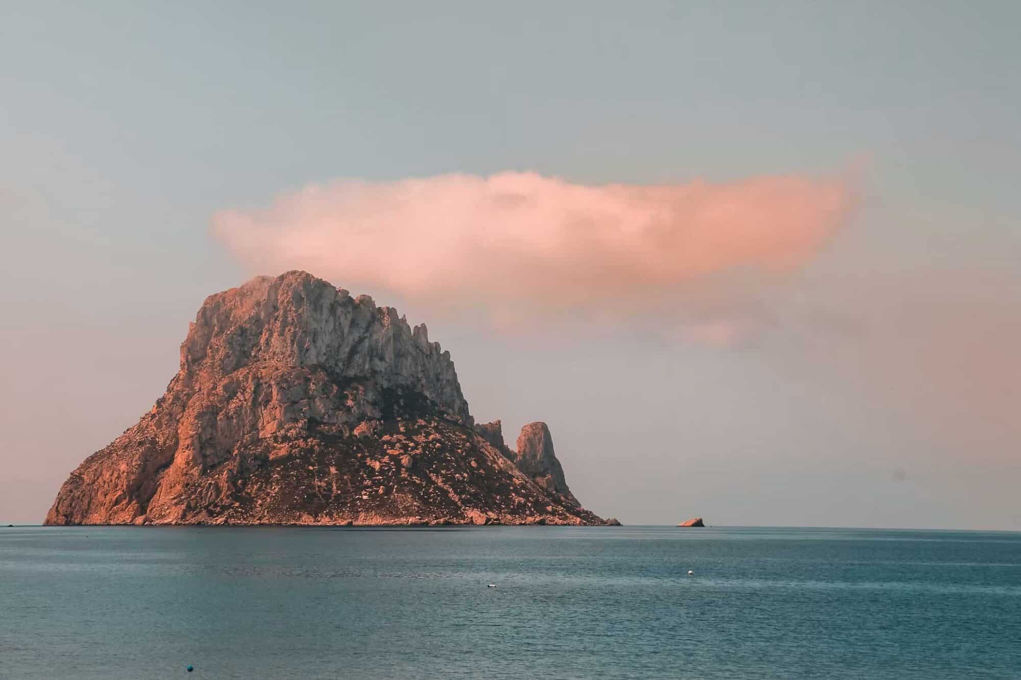
    Cala d’Hort is the essential sunset position. Es Vedrà rises 382 metres (1,253 feet) from the sea offshore, creating one of the archipelago’s most recognisable silhouettes. The anchorage can become crowded and exposed, so it is often better to arrive during the afternoon, enjoy the view and relocate before darkness unless conditions are exceptionally settled.

    Cala Conta offers a broader western outlook and another strong sunset. Cala Bassa is more sheltered but busier. Cala Porroig provides a quieter alternative, while Cala Jondal is the address for dining and social life.

    For a refined seafood lunch, Casa Jondal is the clear choice. Chef Rafael Zafra’s cooking turns a beach restaurant into a serious gastronomic destination. The atmosphere is elegant but conspicuous, and prices match its reputation.

    For traditional Ibizan character, Yemanjá offers a more relaxed Cala Jondal experience. For music, spectacle and a high-energy crowd, Blue Marlin remains the obvious option. These places are not interchangeable. Choose the atmosphere before choosing the table.

    The Formentera Anchorages Deliver the Clearest Water

    The passage from Ibiza to Formentera crosses the Freus marine reserve. The water becomes progressively lighter as the seabed rises around the island.

    Ses Illetes is the celebrated stop. The long sandbar produces water of remarkable transparency, but it also attracts large numbers of yachts. Arrive early, use an ecological mooring where required and confirm the seabed visually before deploying an anchor in permitted sand.

    Espalmador feels more remote, although summer traffic can remove any illusion of solitude. Cala Saona, on the west coast, is smaller and better suited to a sunset swim. It can become tight for a large catamaran, so good judgement matters more than proximity to the beach.

    For a classic long lunch, Juan y Andrea at Ses Illetes combines seafood, paella and an animated barefoot atmosphere. Es Molí de Sal occupies a former salt mill and offers a more composed setting, with views towards both Illetes and La Savina. It is the stronger choice for an elegant lunch that drifts towards sunset.

    The best approach is to anchor responsibly, arrive by tender and accept that lunch may last three hours. Formentera should never be rushed.

    The Menorcan Calas Reward Owners Who Follow the Weather

    Menorca is less polished and more exposed. Its southern coast is defined by pale limestone, pine forests and turquoise calas. Cala Macarella, Macarelleta and Cala Mitjana are the best-known examples.

    They are superb swimming stops, but limited space makes early arrival important for a yacht over 15 metres. The rocky margins of Cala Macarella are excellent for snorkelling when visibility is good.

    The northern coast is different. Cala Pregonda has reddish rock, clearer exposure to weather and a landscape unlike the southern beaches. The North Menorca Marine Reserve protects waters between Cap Gros and Punta des Morter. It is one of the island’s best areas for snorkelling and guided diving.

    Fornells provides a useful refuge when conditions allow entry. The large bay offers access to the north while giving the yacht a more secure base than the open calas.

    Menorca requires flexibility. When the tramuntana strengthens, the north coast can become uncomfortable quickly. The southern calas then become the logical alternative. A fixed itinerary is less valuable than the freedom to change coast overnight.

    The Underwater Itinerary Belongs in the Cruising Plan

    The Balearics contain several protected marine reserves where underwater life is richer than around heavily used beaches.

    Mallorca’s Illa del Toro is one of the most established diving areas. Rocky walls, groupers and schools of fish make it a stronger scuba destination than an ordinary coastal reef. Cabrera offers an even more protected environment, although permits and authorised diving arrangements are required.

    Formentera’s Freus reserve is well suited to snorkelling in clear, shallow water. Menorca’s northern reserve offers rocky habitats and less urban pressure.

    A yacht should not simply arrive and launch divers independently. Local regulations vary by reserve, and professional dive centres understand authorised zones, weather and current conditions. The boat remains the private base. The specialist operator provides local knowledge.

    The Experiences Ashore Complete the Voyage

    Mallorca’s inland vineyards provide the strongest wine experience. The island has two principal designations of origin: Binissalem and Pla i Llevant. Binissalem includes 13 registered wineries and is associated with local varieties such as Manto Negro and Moll.

    Macià Batle, Biniagual and Tianna Negre offer different expressions of Mallorcan wine culture. A private transfer from Palma, Port d’Andratx or Port de Sóller turns the visit into a full day ashore.

    On Menorca, the Camí de Cavalls circles the coast for 185 kilometres (115 miles) in 20 official stages. There is no need to walk the entire GR 223. A section near Cala Galdana, Macarella or Cap de Cavalleria is enough to understand the island beyond its beaches.

    Formentera is best explored by bicycle or scooter. La Mola lighthouse provides the island’s broadest outlook, while Ibiza’s inland villages reveal a quieter agricultural landscape far removed from the clubs.

    The finest sailing holiday in the Balearic Islands is not built from a checklist. It moves between wilderness and civilisation. One day ends alone beneath Cabrera’s dark sky. The next may involve lunch at Cala Jondal or a sunset behind Es Vedrà.

    From the deck of a long-range catamaran, that contrast is the true luxury. The yacht does not merely transport its owners between islands. It gives them the ability to choose how each day should feel.

  • Sailing the British Virgin Islands Aboard a Large Catamaran

    Sailing the British Virgin Islands Aboard a Large Catamaran

    From The Baths to Anegada’s lobster and the Soggy Dollar’s Painkiller, Privilège Marine charts the British Virgin Islands aboard a large catamaran.

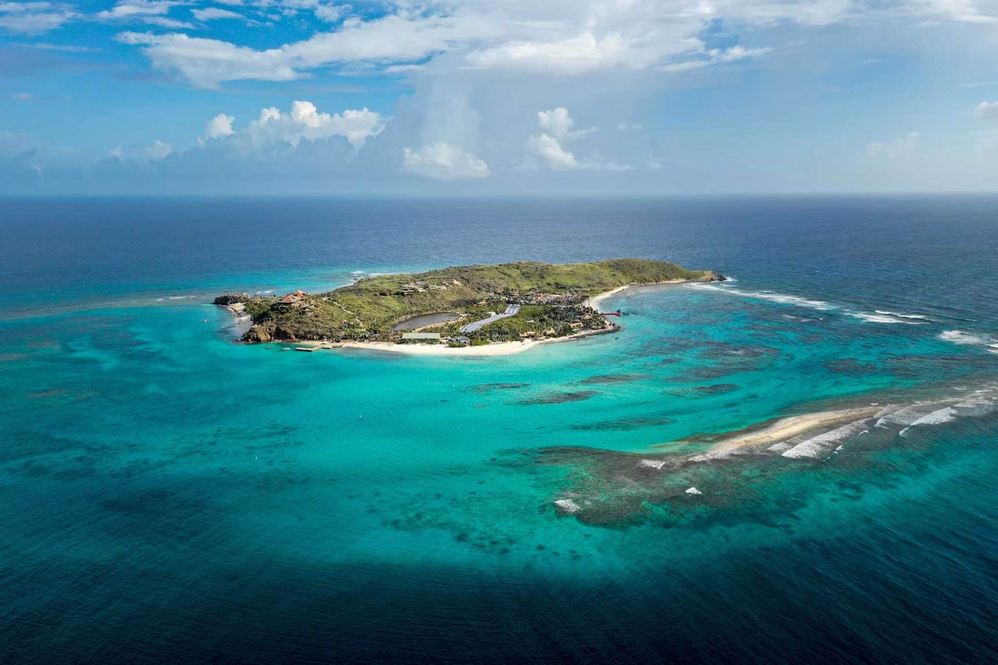
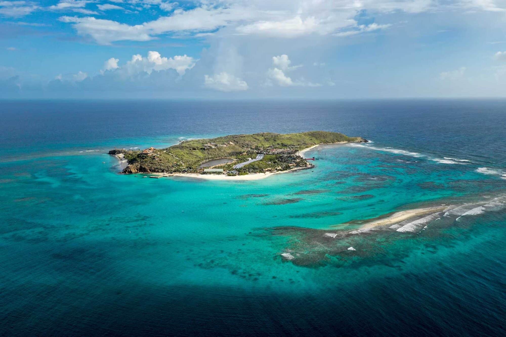
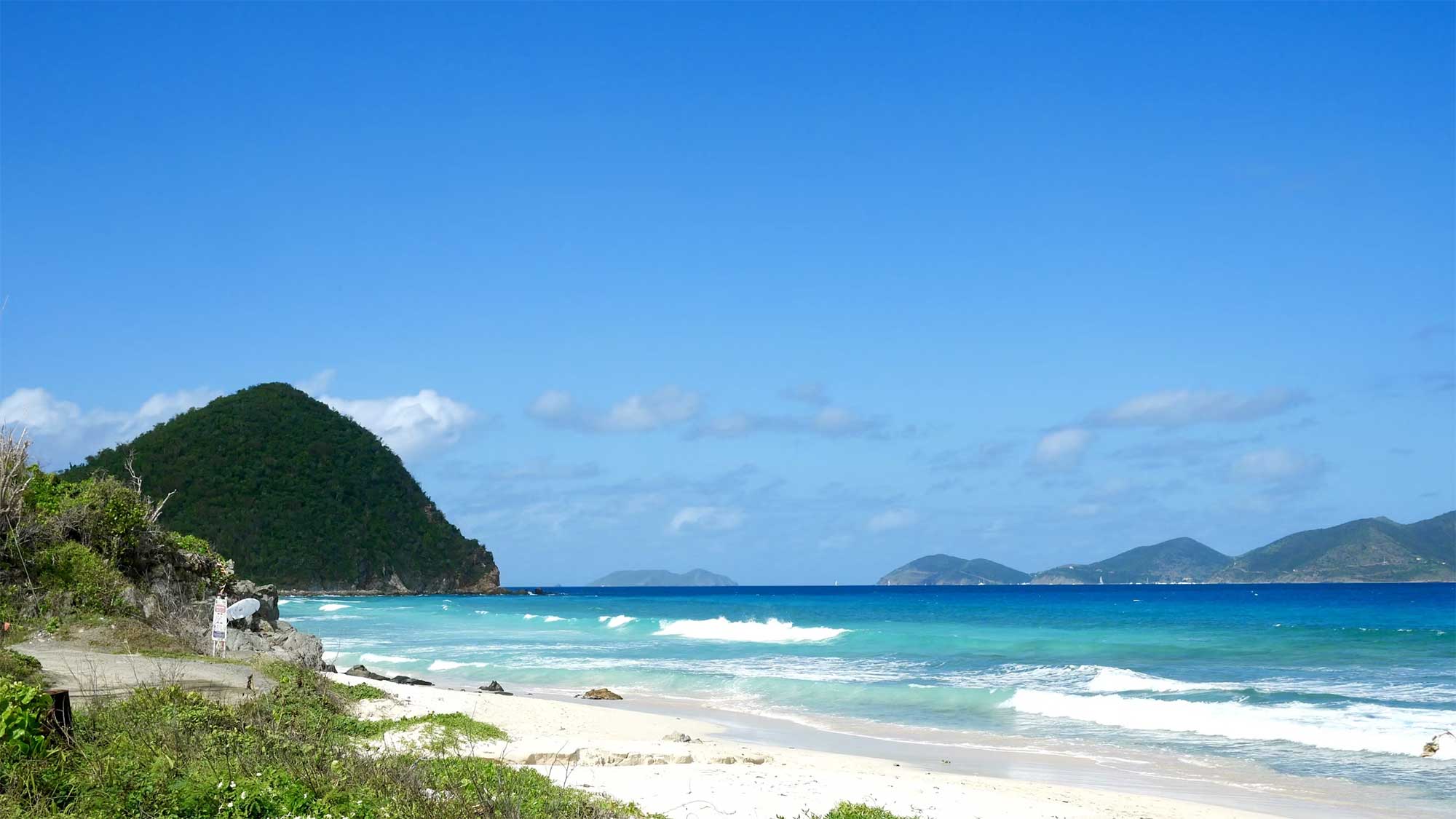
    The British Virgin Islands form one of the world’s most forgiving cruising grounds, and a 50- to 70-foot (15- to 21-metre) catamaran is the ideal way to see them. The islands sit within sight of one another along the Sir Francis Drake Channel, so passages rarely run more than two hours. Steady trade winds, flat water and a dense network of mooring balls make the sailing easy and the days long. The pleasure lies in the stops: the granite grottoes of The Baths, the floating bar at the Willy T, lobster grilled on Anegada, and the original Painkiller at the Soggy Dollar. Big catamarans reach shallow anchorages that deeper yachts cannot, though their beam and length call for planning around the mooring system. Privilège Marine charts where to sail, where to anchor, where to eat and what to do, at sea and ashore.

    The Cruising Ground That Rewards a Big Catamaran

    The appeal of sailing the British Virgin Islands is the geography. Some 60 islands and cays cluster along about 60 kilometres (32 nautical miles) of the Sir Francis Drake Channel, almost always within sight of one another. You navigate by eye. Trade winds blow a reliable 15 to 20 knots through the winter season, the water sits at 26 to 28 degrees Celsius (79 to 82 Fahrenheit), and most hops between anchorages run five to twenty nautical miles. A morning sail, lunch on a beach, an afternoon snorkel: the rhythm sets itself.

    A cruising catamaran suits this place well. Its shallow draft, often around 1.5 metres (5 feet), opens sandy bays that deep-keeled monohulls must skip. Its beam gives stable, level decks for the long hours at anchor that define a charter here.

    The Practicalities of Mooring a Yacht This Size

    Frankness helps here. The BVI runs on mooring balls, not anchors, and a large catamaran has to plan around them. Most park and commercial moorings are rated to about 55 feet (17 metres), so a 60- or 70-foot (18- to 21-metre) yacht often needs a large commercial mooring, a marina berth, or a careful anchor in sand. The buoys are colour-coded: red and orange for day use, white for daytime diving, blue for dinghies, and larger yellow balls for vessels over 55 feet. A National Parks Trust permit is mandatory, and many balls are booked through the BoatyBall app, which opens reservations at 07:00 and sells out within minutes at popular spots. North Sound on Virgin Gorda, deep and sheltered, is the natural base for a yacht this size, with berths at Bitter End, Leverick Bay and Scrub Island nearby. One rule is absolute: nobody sails the BVI after dusk.

    The Islands and Anchorages Worth Your Wake

    A counter-clockwise loop from Tortola takes in the best of them. Norman Island anchors the south, where the Bight offers a broad, protected bay and the nearby Caves and the Indians give some of the archipelago’s finest snorkelling. Peter Island holds Deadman’s Bay, a crescent of sand with pirate history and room to swim. Cooper Island’s Manchioneel Bay enforces a strict no-anchoring policy to protect its turtle grass, so a mooring is essential.

    Salt Island guards the RMS Rhone, a Royal Mail steamer that sank in a hurricane in 1867 with the loss of more than 120 lives. She lies in 9 to 26 metres (30 to 85 feet) and ranks among the Caribbean’s great wreck dives. Virgin Gorda delivers the headline sights at The Baths and the playground of North Sound. Anegada, the only coral atoll in a chain of volcanic peaks, lies low on the horizon 20 kilometres (11 nautical miles) north, ringed by the 29-kilometre (18-mile) Horseshoe Reef. Jost Van Dyke closes the loop in the northwest, with White Bay and Great Harbour. Between them sit jewels like Sandy Spit and the Dog Islands, whose Coral Gardens reward a calm-day snorkel.

    The Beach Clubs Where the Fleet Gathers

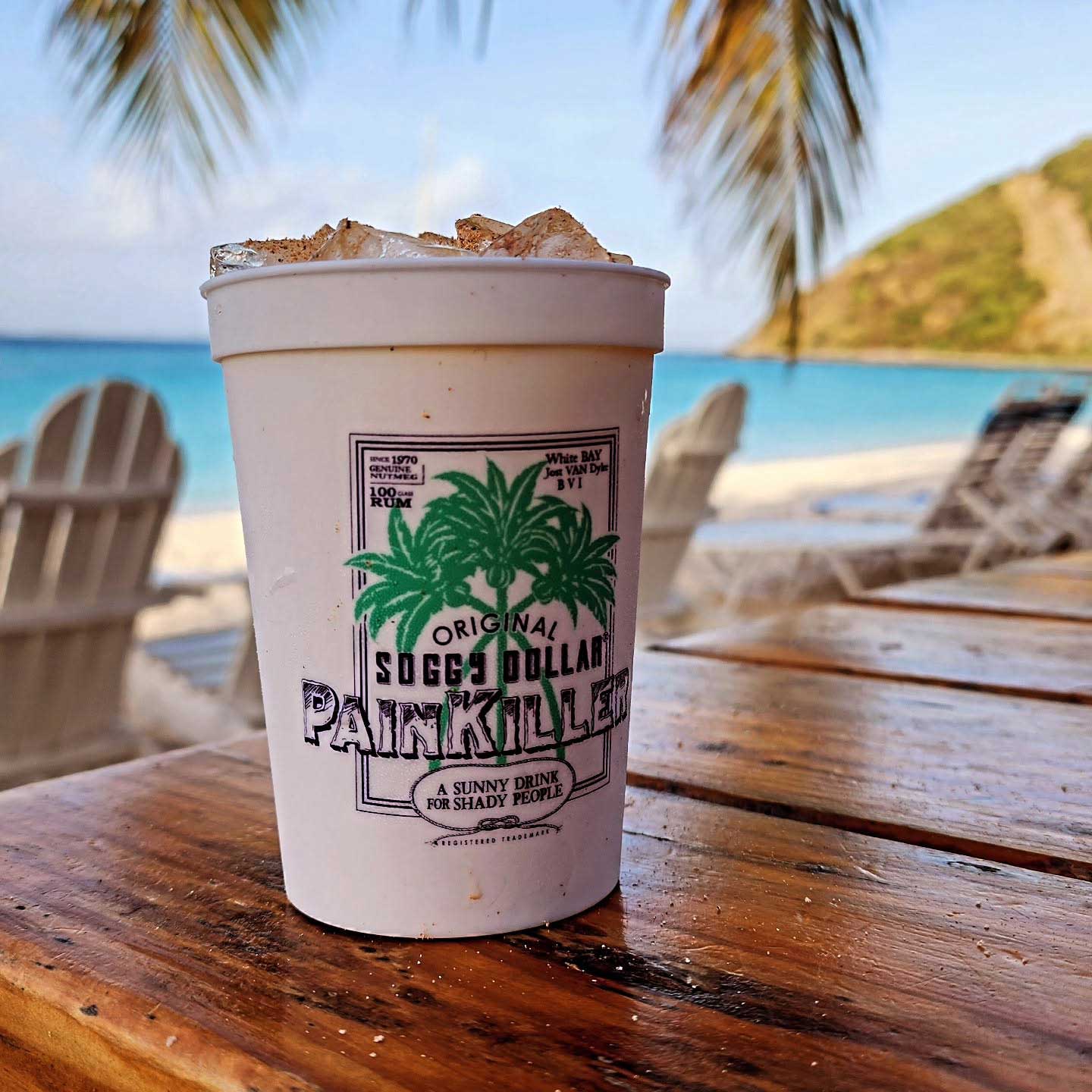
    Few cruising grounds have so many institutions packed so tightly. The Soggy Dollar Bar in White Bay, Jost Van Dyke, is the most famous of all. It invented the Painkiller in the 1970s, and its name comes from the soggy banknotes of sailors who swam ashore to drink. A short walk away, Foxy’s in Great Harbour has run since 1968 under the irrepressible Foxy Callwood, with weekend beach barbecues that draw the whole fleet. Next to the Soggy Dollar, Hendo’s Hideout offers a more polished take on the same beach.

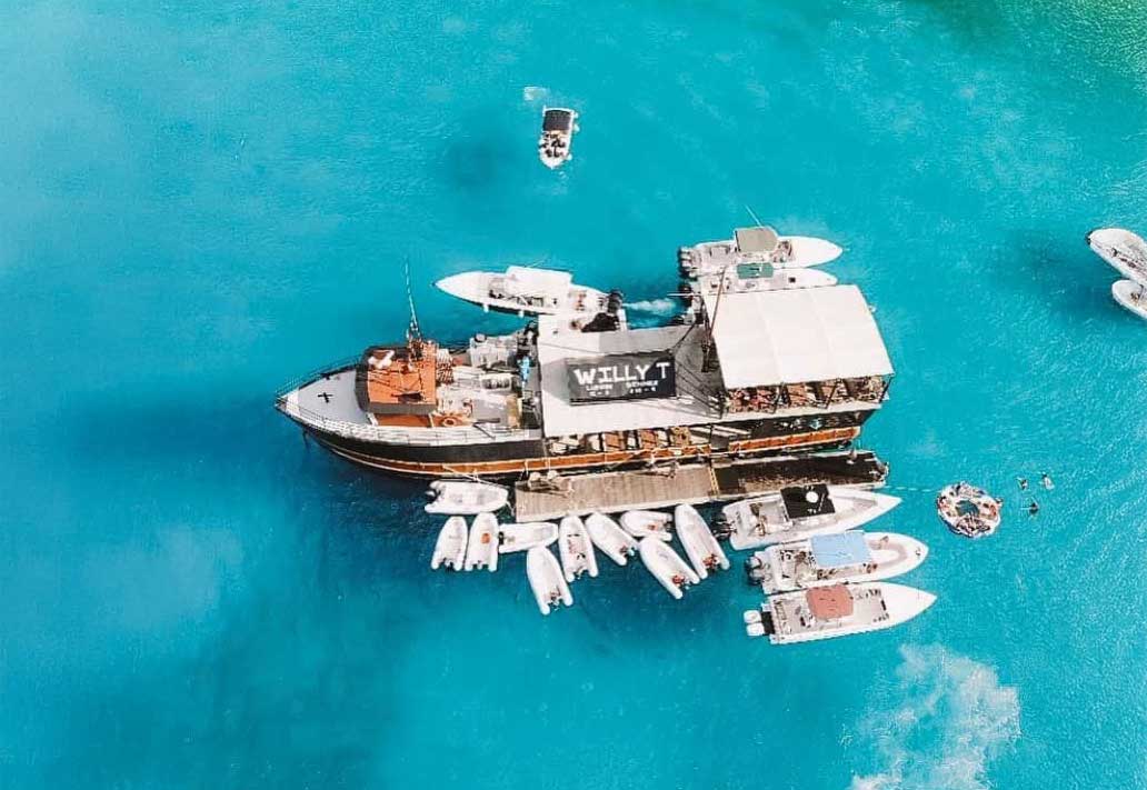
    Off Norman Island, the Willy T floats in the Bight, rebuilt after Hurricane Irma and as raucous as ever. Cooper Island Beach Club is the considered choice: an eco-resort whose rum bar pours more than 280 labels, beside the first solar-powered microbrewery in the islands. In North Sound, Saba Rock and the Bitter End Yacht Club have both reopened and once again anchor the evening scene, while Oil Nut Bay and Leverick Bay add polish. On Virgin Gorda’s west side, CocoMaya serves elegant beachfront plates around fire pits, and Pirates Bight keeps the party going back at Norman Island.

    The Local Table: Lobster, Conch and the Painkiller

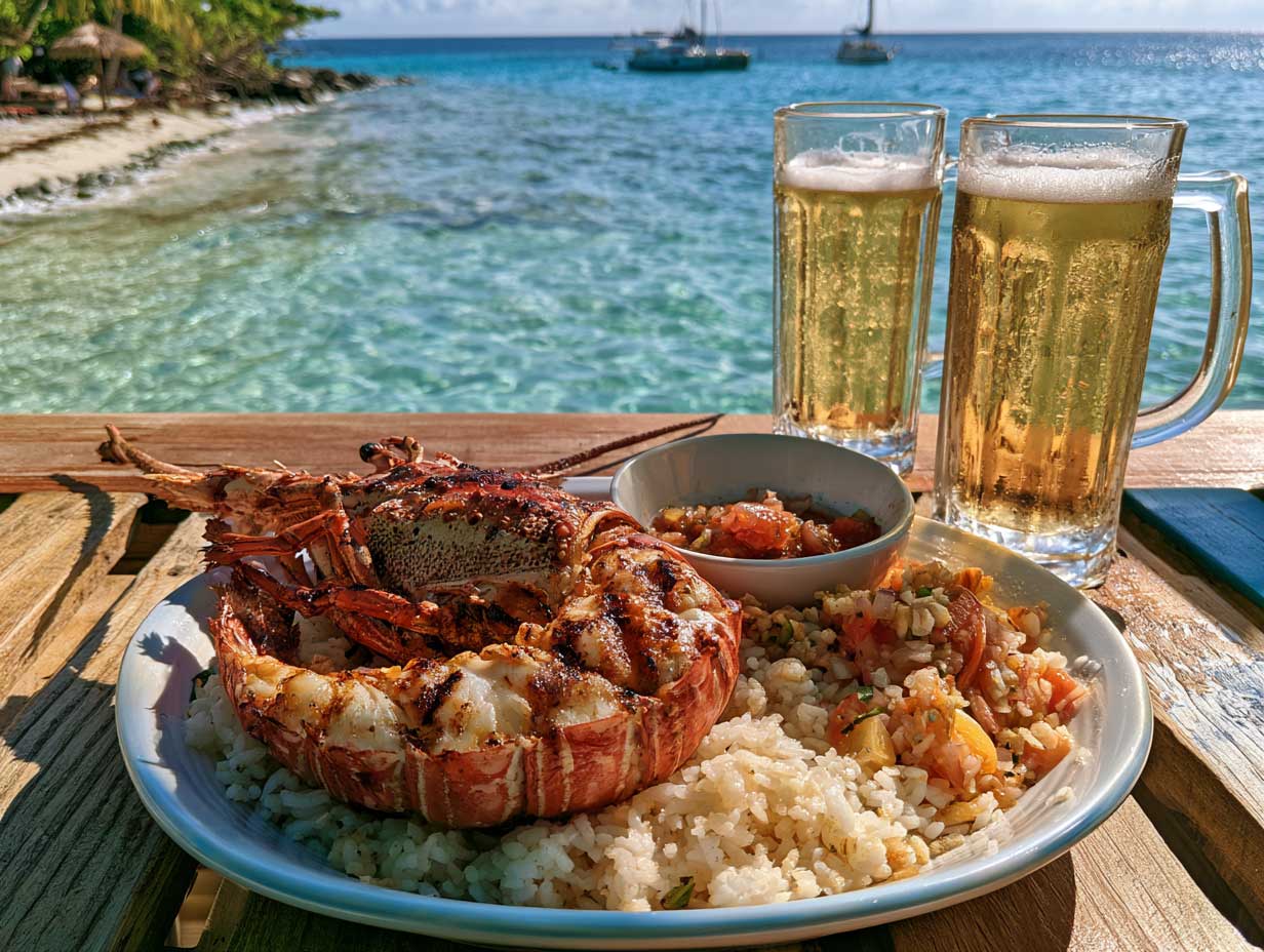
    The food here is simple, fresh and tied to the sea. Anegada lobster is the dish that defines the islands, a sweet spiny lobster grilled over open coals on the beach. Eat it at the Anegada Reef Hotel, at Potter’s by the Sea, or barefoot at the Cow Wreck Beach Bar, and book ahead, since the catch is counted by the day. The island’s November lobster festival is worth timing a voyage around.

    Conch appears everywhere, in fritters and in a slow-cooked chowder. Look also for fungi, the cornmeal-and-okra staple that gives BVI cooking its backbone, for goat or chicken roti, and for johnny cakes fried golden. The Painkiller completes the table: dark rum, cream of coconut, pineapple and orange juice, dusted with grated nutmeg. On Tortola, Myett’s in Cane Garden Bay is the reliable stop for a sit-down local meal ashore.

    The Experiences That Define a Voyage Here

    The single sight no one should miss is The Baths on Virgin Gorda. House-sized granite boulders form a maze of grottoes and tidal pools, including the famous Cathedral Room, that you scramble and swim through to reach Devil’s Bay. Take a mooring, since anchoring is banned. Day-use balls run about 30 US dollars, park admission is 3 US dollars per person, and drones, fishing and glass are forbidden. Go at first light, before the day boats arrive, and heed the red flags that signal dangerous rip currents.

    The water offers more. Dive or snorkel the Rhone off Salt Island. Snorkel the Indians and the Caves at Norman Island, and the Coral Gardens at the Dogs. On Jost Van Dyke, hike the short trail to the Bubbly Pool, a natural rock basin that froths like a jacuzzi when the swell rolls in. North Sound and Eustatia are superb for kitesurfing and paddleboarding in flat, protected water.

    Ashore, Anegada repays a rented jeep. Its salt ponds shelter a restored colony of Caribbean flamingos, and Conch Island, built from centuries of discarded pink shells, sits offshore as a strange monument to the local trade. These are the days that turn a sailing holiday into a memory worth keeping.

    The Rhythm You Will Want to Keep

    What stays with you is the cadence. Short sails, long swims, a different anchorage each night, and an evening ashore that ranges from a plastic chair at Foxy’s to fire pits at CocoMaya. A large catamaran lets you hold that rhythm in comfort, with the shallow draft to reach the quiet bays and the space to live well between them.

    At Privilège Marine, we build catamarans as floating homes meant to carry their owners to places exactly like this one. The British Virgin Islands ask little of the sailor and give a great deal in return. The reward is time, spent on the water, among islands that still feel like a secret shared between the boats that visit them.

  • Sardinia by Catamaran: Where to Anchor, Dine and Go Ashore

    Sardinia by Catamaran: Where to Anchor, Dine and Go Ashore

    The best Sardinian coves, marinas, restaurants and clubs for 50 to 70 ft luxury catamarans, from calm bays to Porto Cervo nightlife.

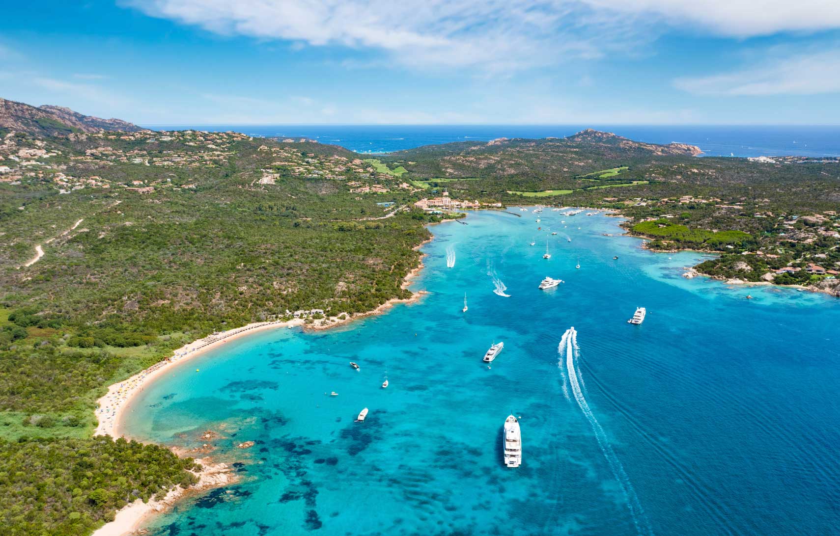
    Sardinia is one of the most rewarding cruising grounds in the Mediterranean for a large luxury catamaran. A 50 to 70 ft yacht, about 15.2 to 21.3 metres, can use the island in a way that neither a small day boat nor a deep-draft superyacht can. It can anchor in clear water, remain stable overnight, carry guests in comfort and move between quiet coves, serious marinas, beach clubs and high-end restaurants. The best areas depend on the mood of the owner. Cala di Volpe and Romazzino deliver elegance and calm. Liscia Ruja and Cala Petra Ruja suit beach-club days. Porto Cervo brings restaurants, regattas and status. Baja Sardinia has the strongest sunset and nightlife scene. La Maddalena offers the most spectacular scenery. Tavolara gives a wilder southern alternative. For Privilège Marine owners, Sardinia is a perfect demonstration of freedom at sea.

    The large catamaran reads Sardinia differently

    Sardinia is often sold through beach photography. For the owner of a large catamaran, it should be read through shelter, seabed, tender access, berth availability, restaurants, clubs and wind direction.

    A 50 to 70 ft catamaran, roughly 15.2 to 21.3 metres, needs more than a pretty bay. It needs space to swing. It needs holding that is suitable for anchoring. It needs protection from the Maestrale when the north-westerly wind builds. It needs safe tender landings. It also needs a plan B in a marina when weather, guests or logistics require it.

    This is why Sardinia works so well for a Privilège Marine owner. Our yachts are built for ocean passages, but they are also floating homes. The same qualities that matter offshore become valuable along the Sardinian coast. Autonomy allows the yacht to stay longer at anchor. Beam creates stability. A protected cockpit turns the anchorage into a living room. A real galley allows lunch on board when restaurants are full. Proper storage supports several days away from shore.

    Sardinia gives owners a rare choice. They can anchor in quiet water in the morning, send a tender ashore for lunch, return to the yacht for the afternoon, then move by tender or car to dinner and music in the evening. The yacht remains the private base. The island provides the atmosphere.

    The best itinerary should combine silence and social energy. It should avoid treating the coast as a checklist. Sardinia rewards owners who stay in fewer places and understand them properly.

    The Costa Smeralda is the natural gateway for large yachts

    The Costa Smeralda is the logical starting point for most large catamaran cruises in Sardinia. It concentrates marinas, anchorages, restaurants, clubs, hotels, provisions, technical services and fast access to Olbia Costa Smeralda Airport. For owners flying in with family or guests, that matters.

    Marina di Porto Cervo is the symbolic centre. It offers around 700 berths and can accommodate yachts up to 160 metres, which means a 50 to 70 ft catamaran sits comfortably within its operating range. It is the best marina for owners who want high visibility, luxury retail, yacht services, regatta culture and direct access to Porto Cervo’s restaurants.

    IGY Portisco Marina is more practical as an operational base. It has 589 berths and accepts yachts up to 90 metres, with deep water and a location between Porto Cervo and Porto Rotondo. It is a strong choice for provisioning, crew changes, repairs and a quieter first or last night. Cala dei Sardi is another useful base, especially for catamarans and charter logistics. It sits close to the Gulf of Cugnana and gives easy access to Porto Rotondo, Portisco and the northern Costa Smeralda.

    Marina di Olbia is less glamorous, but it is extremely useful. It offers 270 berths and can take large yachts, with direct proximity to the airport, city services and road connections. For owners who value efficiency over display, Olbia is a sensible embarkation point.

    For restaurants near this first cruising zone, Porto Rotondo gives two easy names. Tartarughino is useful for owners who want a relaxed seafood lunch or dinner with a polished but informal local mood. It works well after a day at anchor near Porto Rotondo or after a berth in Portisco. Bambusa, in Piazzetta I Ginepri, is better for a more cosmopolitan dinner, with Mediterranean cuisine influenced by international flavours. It suits guests who want a polished port evening without the intensity of Porto Cervo.

    For nightlife, Country Club Porto Rotondo is the local reference. It has been part of the Porto Rotondo summer scene since 1980 and is the place to choose when the group wants dinner to become a long night. It is less showy than some Porto Cervo addresses, but it has history, music and a more local Costa Smeralda rhythm.

    The Cala di Volpe anchorage is the elegant centre of the coast

    Cala di Volpe is one of the most famous bays in the Mediterranean. Its appeal is easy to understand. The water is clear, the landscape is sculpted by granite, and the bay has a calm, refined atmosphere when the weather is settled. For a luxury bluewater catamaran, it is one of the most comfortable places to spend a day or a night in the right conditions.

    For a 50 to 70 ft catamaran, Cala di Volpe offers space, scenic value and access to some of the most desirable restaurants on the coast. The skipper should still be disciplined. The bay is popular in high season. The anchorage should be chosen with care, avoiding Posidonia seagrass, swimming zones and areas with too much tender traffic. A catamaran’s modest draft helps, but beam and swinging radius still matter.

    The dining scene is the reason many owners return. Matsuhisa at Cala di Volpe is the address for guests who want Nobu-style Japanese-Peruvian cuisine in a Sardinian setting. It works well for a refined evening after a quiet day on board. Beefbar Cala di Volpe is the better choice when the group wants a more international menu built around premium meat, polished service and hotel glamour. Quattro Passi al Pescatore, in Porto Cervo, also fits this area because it is one of the classic waterfront seafood restaurants to book when staying in or near Cala di Volpe and moving ashore by car or tender transfer.

    Cala di Volpe is where owners go for elegant understatement. It has celebrity weight, but it does not need to be loud. Superyachts sit in the bay. Hotel guests move between restaurants and private decks. Tenders run quietly across the water. The best way to use the bay is to anchor early, swim before the traffic builds, have lunch on board, then go ashore for dinner.

    This is not the best place for owners seeking total solitude in August. It is the right place for owners who want scenic beauty, refined dining and the feeling of being inside the classic Costa Smeralda story.

    The Romazzino and Pevero bays are made for calm days with easy access

    Romazzino and Pevero are useful because they sit close to Porto Cervo and Cala di Volpe while offering a softer rhythm. They work well when the owner wants a beautiful anchorage without committing to the theatre of Porto Cervo marina.

    Grande Pevero and Piccolo Pevero are practical in settled weather. The beaches are attractive, the water is clear, and road access from shore is simple. This makes the area useful for guests who want to meet a car, play golf nearby, go to lunch, or move to Porto Cervo in the evening. For a large catamaran, the key is to anchor outside the busy beach zone and keep enough room for wind shifts and other yachts.

    Romazzino is quieter and more discreet. It suits owners who want the Costa Smeralda without its full social volume. The anchorage gives the yacht a strong sense of place: pale sand, blue water, low green hills and granite edges. It is excellent for families, couples and guests who want swimming, paddleboards and lunch on board.

    For restaurants, the best approach is to use the yacht as the base and move by tender or road transfer to Cala di Volpe or Porto Cervo. Matsuhisa and Beefbar remain strong choices from Romazzino. Quattro Passi al Pescatore works well for a more maritime dinner in Porto Cervo. Novikov Porto Cervo is the choice when guests want Asian fusion, a fashionable atmosphere and a terrace view over the bay.

    For a club mood, Pevero is not the strongest area. That is its advantage. It is better for a quiet evening, followed by a short transfer to Porto Cervo if the group changes its mind. Owners who want calm waters should consider this zone carefully, especially outside peak August weeks.

    The Liscia Ruja and Cala Petra Ruja coast is built for beach-club energy

    Liscia Ruja is one of the broadest and most attractive beaches on the Costa Smeralda. For a large catamaran, it offers a more open feeling than Cala di Volpe. The water is bright, the beach is long, and the view toward the offshore islands gives the anchorage a natural sense of space.

    This area suits owners who want a day anchored off a famous beach, with swimming, paddleboards and a relaxed social tone. It is not a protected refuge in all winds, so the skipper must read the forecast carefully. In settled conditions, however, a 50 to 70 ft catamaran can sit beautifully here, with the yacht acting as a private floating beach house.

    Cala Petra Ruja adds a stronger social element because Nikki Beach Costa Smeralda is located there. This is the address to choose when guests want a beach-club lunch, music, sunbeds, champagne, cocktails and a polished international atmosphere. The venue describes its style as barefoot luxury, and that is the right way to use it. It is relaxed in dress, but carefully staged in service.

    The reason to go to Nikki Beach is clear. It gives a group energy without requiring a full marina stop. Owners can keep the yacht anchored, run guests ashore by tender according to local conditions and club arrangements, then return to the privacy of the catamaran when the mood becomes too loud.

    This zone is best for owners who want beach-club energy rather than silence. In July and August, it can be busy. In June and September, it becomes far more attractive. The water is still warm enough for long swims, but the coast feels less crowded.

    The Porto Cervo stop is for restaurants, regattas and status

    Porto Cervo should be used with intention. It is not the quietest stop in Sardinia. It is the place to enter the social and yachting centre of the Costa Smeralda.

    For a 50 to 70 ft catamaran, Marina di Porto Cervo offers the most complete luxury infrastructure in the area. Berthing here gives immediate access to restaurants, boutiques, yacht services, security, provisions and the Yacht Club Costa Smeralda. During the regatta season, the atmosphere becomes especially interesting. The 2026 Yacht Club Costa Smeralda calendar includes events such as the Giorgio Armani Superyacht Regatta, the Rolex TP52 World Championship, the Smeralda 888 events and the Palermo-Porto Cervo-Montecarlo race.

    This is why sailors should go to Porto Cervo at least once. The marina is not only about wealth. It is also one of the Mediterranean’s great sailing stages. Owners who appreciate yacht design, racing culture and maritime theatre will find it worthwhile.

    For dinner, Quattro Passi al Pescatore is the classic choice. It is a waterfront restaurant and one of Porto Cervo’s most established seafood addresses. It suits owners who want dinner to feel connected to the port rather than hidden in a hotel. Novikov Porto Cervo is more urban and international. It works for guests who want Asian fusion, a dressier atmosphere and a fashionable table. For a more hotel-led dinner, the Cala di Volpe restaurants remain within easy reach by road.

    For clubs, Porto Cervo has a changing seasonal scene, so reservations and current programmes matter. The stronger constant is the wider Porto Cervo and Baja Sardinia axis. Owners who want nightlife should plan dinner in Porto Cervo, then move toward Phi Beach or Country Club Porto Rotondo depending on the night.

    Porto Cervo is where celebrities, yacht owners and luxury travellers concentrate because the system is complete. There are marinas, hotels, restaurants, shopping, privacy and security. For some owners, it will feel too staged. For others, it is exactly why they came.

    The Baja Sardinia and Phi Beach area is the sunset and nightlife choice

    Baja Sardinia is the right answer when the brief is action, music and a strong evening atmosphere. It is close enough to Porto Cervo to be part of the same social circuit, but its mood is more sunset-driven and club-oriented.

    Phi Beach is the key venue. It sits at Forte Cappellini and is one of the most established beach-club and nightlife addresses in Sardinia. The reason to go is the setting. The rocks, the west-facing view and the sunset create a natural amphitheatre. The venue then adds dining, DJ sets and a late-night programme.

    For yacht owners, Phi Beach is particularly useful because it provides a tender service and the possibility of booking buoys, subject to availability. This matters for a large catamaran. It reduces the uncertainty of getting guests ashore and makes the evening easier to plan. Owners should still check conditions, availability and local rules before committing.

    The restaurant programme at Phi Beach has evolved, with Luciano’s presented as a restaurant concept inspired by Mediterranean coastal and inland traditions. Nammos Baja Sardinia also brings its high-energy seaside style to the area. These names give the group options. Luciano’s is better for a dinner that still feels linked to Sardinia and the sea. Nammos is the stronger choice when the guests want glamour, music and an international beach-club mood.

    This area is not for a quiet night. It is for the owner who wants the yacht to be the private retreat before and after the party. A Privilège catamaran works well in that role. Guests can spend the day in calm, enjoy sunset ashore, then return to a quiet cabin and a stable platform.

    The La Maddalena Archipelago is the scenic prize with rules

    The La Maddalena Archipelago is the most spectacular cruising area in northern Sardinia. Spargi, Budelli, Razzoli, Santa Maria and Caprera create some of the clearest water and most dramatic granite scenery in the Mediterranean. For a large catamaran, this is where the yacht feels fully justified.

    The area is also a national park. That means the skipper must use current official rules, permits and zone maps. Permits are required. Anchoring is regulated. Posidonia oceanica seagrass must be protected. Overnight anchoring rules have changed in recent years, so captains should verify the current framework before arrival rather than relying on older cruising guides.

    For scenic anchorages, Cala Corsara on Spargi is one of the major names. It is famous for its pale sand, rock shapes and extraordinary water. Budelli’s Spiaggia Rosa is protected and should be admired respectfully from the sea. Caprera is better for owners who want a quieter and more rugged mood, depending on wind and permitted zones. The area around Porto Palma can be useful in the right conditions.

    Restaurants and clubs are more limited here, which is part of the charm. La Grotta in La Maddalena town is a good restaurant to choose for seafood and local continuity. It has been part of the island’s dining scene since 1958 and works well after a day in the park. Zi Antò at Punta Tegge is another strong choice, especially for owners who want a waterfront meal with a more traditional Sardinian feel. La Scogliera, on its private-islet setting near the archipelago, is the more glamorous option. It is the one to choose for a high-end seafood lunch or dinner reached by boat transfer.

    La Maddalena is best for calm seekers, families, swimmers and owners who value landscape over nightlife. It is also where a Privilège’s autonomy matters. The best experience is to slow down, follow the rules, avoid crowded hours and let the anchorage do the work.

    The Tavolara and Punta Coda Cavallo area gives a wilder southern alternative

    South of Olbia, Tavolara and Punta Coda Cavallo offer a different version of Sardinia. Tavolara rises sharply from the sea and gives the area a more monumental character than the Costa Smeralda. The coastline feels wilder. The water around Molara, Tavolara and Cala Brandinchi can be exceptional.

    This area belongs to the Tavolara Punta Coda Cavallo Marine Protected Area. It covers about 15,000 hectares of sea and around 40 kilometres of coastline. Navigation, anchoring and mooring depend on zones. Some areas restrict free anchoring and require official mooring buoys. A large catamaran should plan carefully and avoid improvisation.

    The reason to go is contrast. After Porto Cervo, Cala di Volpe and Baja Sardinia, Tavolara feels cleaner and less social. It suits owners who want natural scenery, swimming and a more elemental day at sea. It is also practical because Olbia remains close.

    The restaurant to know is Da Tonino Re di Tavolara. It is located on Tavolara Island and can be reached by boat, with a pier close to the restaurant. The reason to go is the setting as much as the food. A meal there gives guests the feeling of arriving somewhere by sea, not simply visiting another coastal restaurant. It is simple, memorable and geographically specific.

    For a more refined shore option, Ristorante La Corona on Tavolara is also worth considering. It suits guests who want the island setting with a more polished dining mood. This area is not a club destination. It is a place for lunch, swimming, landscape and a quieter night on board.

    The Cagliari and Villasimius coast rewards longer cruises

    The south of Sardinia is often overlooked by owners who focus only on the Costa Smeralda. That is a mistake for longer cruises. Cagliari, Villasimius and the Capo Carbonara area offer a different rhythm, with broader beaches, strong food culture and less dependence on the celebrity circuit.

    Villasimius and Capo Carbonara are especially attractive for owners who want clear water and natural scenery. The marine protected area requires attention to zones, anchoring rules and seagrass protection. This is another place where the captain should check official information before entering.

    For restaurants, Villasimius works well for a more local dinner after days at anchor. Cagliari is the stronger gastronomic stop. Da Marino al Saint Remy is a useful name for seafood and city dining. Luigi Pomata is a strong choice for tuna, contemporary Sardinian cooking and a more chef-led experience. Antica Cagliari is better for a traditional meal in the old town, especially when guests want Sardinian dishes and a warm local atmosphere.

    For bars and evening life, Libarium Nostrum is one of the more memorable Cagliari choices because of its terrace and city views. It works after dinner rather than as a yacht-club style venue. Cagliari does not have the same yacht glamour as Porto Cervo, but it has a real city behind it. That gives the cruise cultural depth.

    The south suits owners with time. It is better for a two-week itinerary than a short Costa Smeralda escape. It rewards those who want Sardinia beyond the familiar names.

    The ideal Sardinian route depends on the owner’s mood

    The best Sardinian itinerary for a 50 to 70 ft catamaran should be built around mood, not distance.

    For calm, the strongest choices are Romazzino, selected parts of La Maddalena outside peak season, Caprera, Tavolara and the quieter southern coast. For a refined Costa Smeralda feeling, choose Cala di Volpe, Pevero and Porto Cervo. For beach-club energy, go to Nikki Beach at Cala Petra Ruja. For sunset, music and nightlife, go to Phi Beach and Baja Sardinia. For logistics, use Olbia, Portisco, Cala dei Sardi or Porto Cervo. For a proper sailing culture stop, time the visit around the Yacht Club Costa Smeralda calendar.

    The restaurants should follow the area. Cala di Volpe means Matsuhisa or Beefbar. Porto Cervo means Quattro Passi al Pescatore or Novikov. Porto Rotondo means Tartarughino or Bambusa. Baja Sardinia means Phi Beach, Luciano’s and Nammos. La Maddalena means La Grotta, Zi Antò or La Scogliera. Tavolara means Da Tonino Re di Tavolara or La Corona. Cagliari means Luigi Pomata, Da Marino al Saint Remy, Antica Cagliari and Libarium Nostrum.

    This is the real pleasure of Sardinia by catamaran. The yacht gives the owner the ability to change atmosphere without changing identity. A Privilège can be a quiet home at anchor in the morning, a platform for friends at lunch, a tender base for a beach club in the afternoon and a calm private retreat after dinner.

    Sardinia works because it gives that freedom real structure. It has the bays, marinas, restaurants, clubs, protected areas and road access to make a large catamaran meaningful. The owner simply needs to choose the right mood for each day.

  • The Right Season to Sail West Across the Atlantic

    The Right Season to Sail West Across the Atlantic

    When to sail east to west across the Atlantic, why the trade wind route matters, and how to prepare a yacht, crew and paperwork properly.

    Crossing the Atlantic from East to West is not a delivery trip. It is a full ocean passage, a test of seamanship, preparation, patience and judgement. The classic route runs from Europe towards the Canary Islands, then west across the trade wind belt to the Caribbean. For most cruising yachts, the best departure window from the Canaries is late November to January. This timing reduces exposure to the Atlantic hurricane season and allows crews to benefit from more settled north-easterly trade winds. The passage from Las Palmas de Gran Canaria to Rodney Bay, Saint Lucia, is about 2,700 nautical miles, or roughly 5,000 kilometres, and usually takes 18 to 21 days for an average cruising yacht. A good crossing is never improvised. It requires a sound boat, a realistic route, disciplined weather routing, careful provisioning, reliable communications and properly prepared customs, immigration and insurance documents.

    The Atlantic crossing remains one of sailing’s purest adventures

    There are many ways to use a yacht. Some are social. Some are coastal. Some are seasonal. Crossing the Atlantic belongs to another category. It is a passage that changes the way a crew understands a boat.

    At Privilège Marine, we build catamarans for owners who do not see the horizon as a limit. A true bluewater catamaran is not designed only for marina life, charter brochures or short summer hops. It must be able to keep moving safely for weeks. It must remain comfortable when the crew is tired. It must protect people during squalls, support watchkeeping at night, carry stores without losing its balance, and give confidence when the nearest harbour is several days away.

    That is the real interest of an Atlantic crossing east to west. The passage forces clarity. Every choice made before departure becomes visible at sea: the quality of the rig check, the logic of the sail inventory, the condition of the autopilot, the realism of the provisioning plan, the calm of the skipper, and the ability of the crew to live together in a small offshore society.

    The romance is real, but it is not enough. There will be superb days: long following seas, flying fish on deck at dawn, warm nights under a moonless sky, and the strange satisfaction of noon positions slowly eating into the chart. There will also be fatigue, chafe, broken blocks, salt everywhere, confused seas, sudden squalls and long hours of conservative decisions. That is why the crossing is a real adventure. Not because it is reckless, but because it is serious.

    The best season is defined by hurricanes and trade winds

    The first question is simple: when should a yacht cross the Atlantic from Europe to the Caribbean? The honest answer is that the best window is usually from late November to January, with December often considered the centre of the season.

    The reason is meteorological, not romantic. The official Atlantic hurricane season runs from June 1 to November 30. The statistical peak is around September 10, with most activity concentrated between mid-August and mid-October. Leaving too early in autumn may feel efficient, but it increases exposure to late tropical systems or disturbed weather near the eastern Caribbean.

    Waiting too long has another cost. By February and March, the trade winds can be stronger and more established. That can produce a fast passage, but also a more muscular one, with bigger seas, more pressure on the rig, and a higher chance of tired crew and damaged gear. Many experienced skippers still cross then, but it is not always the most comfortable choice for a family yacht or a newly formed crew.

    November is a transition month. It is attractive because it is the traditional departure period for many Atlantic rallies, including the ARC from Las Palmas to Saint Lucia. Yet early November can still be unsettled. A prudent skipper does not sail because a date was printed in a calendar. He sails because the weather window is acceptable.

    For a private owner planning carefully, the strongest answer is this: move the yacht south through Europe, Portugal, Madeira or the Canary Islands during September, October and early November; prepare in the Canaries; then depart when the tropical risk has reduced and the north-easterly trades are properly in place.

    The classic route follows the logic of the North Atlantic

    The traditional westbound route exists because the ocean makes it logical. The North Atlantic is shaped by large-scale wind and current systems. The Azores High helps generate the clockwise circulation that supports the north-easterly trade winds. These winds push air from the subtropical high-pressure belt towards lower pressure nearer the equator, while the rotation of the Earth bends them into a north-east to south-west flow.

    For sailing yachts, that creates the famous trade wind route. From the Canary Islands, the common strategy is not to sail a straight line west at all costs. The older saying was to “sail south until the butter melts”, then turn west. The modern version is more precise: sail far enough south to find stable trades, then shape the westward leg according to weather, sea state, crew condition and destination.

    This is why a route from the Canary Islands to Caribbean often begins with a south-westerly component. Boats may head towards the latitude of Cape Verde before committing fully west. The objective is not to add miles for pleasure. It is to reduce the risk of being trapped near the southern edge of the Azores High, where light winds can lead to days of motoring, fuel anxiety and slow progress.

    The distance from Las Palmas de Gran Canaria to Rodney Bay, Saint Lucia, is about 2,700 nautical miles, or close to 5,000 kilometres. In practice, many yachts sail closer to 2,800 or 3,000 nautical miles, depending on how far south they go and how much they route around weather. An average cruising yacht often takes 18 to 21 days. A faster multihull can do better, but speed should not be the only measure of success. A clean arrival with a rested crew and an intact yacht is the result that matters.

    The currents help, but the wind still writes the passage

    Currents matter on an Atlantic passage, but they should not be exaggerated. The wind is the main engine. The current is the background assistance or penalty.

    From Europe, the Canary Current forms part of the eastern side of the North Atlantic gyre. Farther south, the west-setting North Equatorial Current broadly supports the movement towards the Caribbean. Near the islands, local effects can matter more than oceanic theory: acceleration zones in the Canaries, wind shadows behind high volcanic islands, acceleration near headlands, and confused seas where swell, current and local wind meet.

    A westbound yacht should also understand what not to do. The Gulf Stream is a powerful current, moving at about one to three knots in places, but it is not the main helper for the classic Europe-to-Caribbean crossing. It is more relevant to routes near the American coast and to return passages towards Bermuda, the Azores and Europe.

    On the westbound leg, a favourable current may add comfort and distance over the ground. It does not remove the need for good sail trim, sensible routing and active watchkeeping. A catamaran that sails efficiently at moderate angles will often make better daily runs by avoiding deep, slow dead-downwind sailing. Apparent wind, sail balance and sea state matter. On many performance-capable cruising catamarans, the best solution is often a controlled downwind angle, with planned gybes, rather than simply pointing the bows at the waypoint and dragging canvas behind the boat.

    The best departure ports are chosen before the ocean starts

    A serious crossing does not begin at the edge of the Atlantic. It begins in the shipyard, then in the maintenance plan, then in the staging ports.

    For an owner leaving from Les Sables d’Olonne, the journey south is part of the preparation. The Bay of Biscay demands respect, especially in autumn. Portugal offers useful stops such as Cascais and Lagos. Madeira can be a valuable intermediate landfall. The Canary Islands remain the most established launch platform for a westbound passage because they offer marinas, repair services, provisioning, chandlery, crew changes and a community of other ocean-bound yachts.

    Las Palmas de Gran Canaria is the best-known departure port. It is the start of the ARC and one of the most practical places in the Atlantic to complete final preparations. Tenerife, Lanzarote, La Gomera and Gran Canaria also provide alternatives depending on weather, berth availability and the owner’s programme.

    The Cape Verde option deserves special attention. Stopping in Mindelo breaks the passage into two more manageable legs: roughly 850 nautical miles from the Canaries to Cape Verde, then about 2,000 to 2,200 nautical miles to the Caribbean, depending on the final landfall. This route has clear advantages. It gives the crew a first offshore test, allows repairs before the longest leg, and places the yacht farther south, where the trades are often more reliable.

    The trade-off is administrative and logistical. Cape Verde adds a clearance stop, possible marina congestion, and another departure procedure. For many crews, it is still worth it. A controlled pause before the main ocean leg can be more intelligent than forcing a nonstop passage with unresolved technical issues.

    Atlantic Ocean Crossing

    The Caribbean landfall should match the yacht’s next life

    Saint Lucia is the symbolic landfall for many crews because Rodney Bay is the finish of the ARC. It offers marina services, customs and immigration, provisioning, repairs and onward access to the Windward Islands. The Pitons also provide one of the most memorable arrivals in the Caribbean.

    But Saint Lucia is not the only answer. Martinique, especially Le Marin, is highly practical for French-speaking owners and yachts needing technical support. Guadeloupe can suit those planning to cruise the French Antilles. Antigua is attractive for yachts heading north towards the Leeward Islands, English Harbour, Falmouth Harbour and the winter superyacht circuit. Barbados can be a logical first landfall for a more southerly route because it lies farther east than many Caribbean islands. Grenada is useful for yachts planning to remain in the southern Caribbean or continue west.

    The right arrival point depends on four questions. Where will the yacht cruise after arrival? Where can the crew fly home or join? Where are the repair and marina services suitable for the boat? What are the customs and immigration requirements for the flag, owner and crew?

    This last point is not paperwork for later. It is passage planning. Arrival after three weeks at sea is not the moment to discover that a crew member needs a visa, that an online pre-arrival form was required, or that the insurance policy excludes a named area.

    The paperwork is part of seamanship

    Administrative preparation is less glamorous than sail selection, but it is part of good seamanship. Before departure, the skipper should verify passports, visas, crew lists, boat registration, radio licence, MMSI registration, EPIRB registration, insurance, vaccination or health declarations where relevant, and the clearance requirements of the departure and arrival countries.

    For yachts leaving the Schengen area, non-EU crew must pay close attention to the Entry/Exit System. Since April 2026, the EU Entry/Exit System records short-stay non-EU nationals electronically at external borders. ETIAS, the European travel authorisation for visa-exempt travellers, is scheduled to begin later in 2026. These systems matter for crew joining or leaving the yacht in Europe, and for any later return.

    On the Caribbean side, many islands require pre-arrival information, customs forms and immigration declarations. Saint Lucia, for example, uses formal entry ports such as Rodney Bay Marina, and vessels may remain for up to three months unless an extension is requested. SailClear and national immigration portals are increasingly common in the region. Requirements differ between islands, so the skipper should check each country before departure, not during the final night at sea.

    The traditional yellow Q flag still has meaning. On arrival, the yacht should follow local procedures, fly the correct signal where required, and ensure nobody goes ashore before clearance unless authorised. Firearms, drones, pets, prescription medicines, alcohol, spare parts and high-value equipment may all trigger specific rules. A luxury yacht has no exemption from customs law.

    The boat must be prepared for repetition, not drama

    Ocean preparation is not mainly about surviving a single storm. It is about reducing the number of small failures that become serious because the yacht is far from land.

    The essential list is long. The rig should be inspected before departure, including terminals, spreaders, halyards, sheaves and attachment points. Downwind sails must be checked for cloth condition, furling reliability and chafe points. Reefing systems must work under load. Preventers, barber haulers, blocks, sheets and spare lines must be sized for repeated use. Autopilots deserve particular attention because they may steer for most of the passage. A spare drive unit, spare ram parts or a proven emergency steering plan can change the outcome of a crossing.

    Energy management is equally important. A modern cruising catamaran depends on navigation instruments, autopilot, communications, refrigeration, lighting, watermaker, pumps and domestic systems. Solar, alternators, generator capacity and battery health should be assessed realistically. A watermaker is valuable, but the yacht should still carry stored water. Redundancy is not pessimism. It is respect for distance.

    Safety equipment must be current and accessible: liferaft, EPIRB, AIS, lifejackets, tethers, jacklines, flares or electronic distress signals, grab bag, medical kit, satellite communications and fire equipment. Crew must know where things are and how they work. A safety briefing the evening before departure is too late if people have not practised.

    The catamaran changes comfort, but not responsibility

    An Atlantic passage on a catamaran is different from the same crossing on a monohull. The platform is level. Watchkeeping can be less tiring. The saloon offers wide visibility. The galley is easier to use. Cabins remain more liveable. Families and guests often adapt better because the boat does not heel for weeks.

    These are real advantages. They are also sometimes misunderstood. A catamaran is not a floating apartment that happens to cross oceans. It is a sailing vessel with high loads, high stability and its own rules. Because it does not heel like a monohull, it does not always give the same physical warning when overpressed. Sail reduction must be early and disciplined. Squalls at night must be treated seriously. Apparent wind can rise quickly. A comfortable boat can make crews complacent if procedures are weak.

    This is why Privilège Marine places offshore use at the centre of the design conversation. Weight distribution, helm protection, visibility, structural integrity, storage, access to systems, ventilation, machinery layout and watchkeeping ergonomics all matter at sea. The Atlantic does not reward decorative thinking. It rewards coherent design.

    The realistic planning calendar begins months before departure

    A sensible westbound programme often looks like this. In spring and summer, the owner completes technical works, safety updates and offshore training. In late summer, the yacht performs loaded sea trials. In September or October, the boat moves south from northern Europe, allowing time for Biscay, Portugal, Madeira or Morocco if needed. In November, the yacht reaches the Canary Islands for final checks, provisioning and crew arrival. In late November, December or January, the crew departs on the main crossing.

    This schedule has one great advantage: it keeps pressure under control. The most dangerous phrase before an ocean passage is “we have to leave tomorrow”. No private yacht has to leave tomorrow. Flights can be changed. A berth can be extended. Fresh food can be bought again. A weather window cannot be negotiated with.

    The best time to cross the Atlantic is therefore not a fixed date. It is the intersection of season, weather, yacht readiness and crew readiness. If one of those four elements is missing, the departure is premature.

    The final decision belongs to the skipper, not the calendar

    A well-prepared Atlantic crossing from East to West is one of the most satisfying passages a yacht can make. It has history, logic, beauty and technical depth. It links Europe with the Caribbean through a route shaped by trade winds, currents and centuries of seamanship.

    But the crossing should never be sold as easy. It is accessible to well-found yachts and competent crews. It is not casual. The ocean is generous with patient sailors and unforgiving with hurried ones.

    For owners, the reward is not only arrival in Saint Lucia, Martinique, Antigua or Grenada. The reward is the confidence built during the passage: the knowledge that the yacht can cross an ocean, that the crew can work together, and that distance can be managed with judgement rather than anxiety.

    That is the real privilege of the Atlantic. Land disappears. The boat becomes the world. And after nearly 5,000 kilometres of moving water, the first Caribbean hill on the horizon feels less like a destination than proof that the preparation was worth it.